
Échez
| Échez | |
|---|---|
_pont_sur_l%27Echez.JPG) | |
  | |
| Location | |
| Country | France |
| Physical characteristics | |
| Source | |
| - location | Hautes-Pyrénées |
| Mouth | |
| - location | Adour |
| - coordinates | 43°28′25″N 0°1′53″E / 43.47361°N 0.03139°E |
| Length | 64 km (40 mi) |
| Basin size | 168 km2 (65 sq mi) |
| Discharge | |
| - average | 3 m3/s (110 cu ft/s) |
| Basin features | |
| Progression | Adour→ Atlantic Ocean |
The Échez is a river in southwestern France that flows through in the Occitanie region.
It is a left tributary of the Adour river, in the French department of Hautes-Pyrénées.
Geography[change | change source]
The Échez river has a length of 64.1 km (40 mi),[1] and a drainage basin with an area of approximately 411 km2 (159 sq mi).
Course[change | change source]
The Échez river is born at the foot of the Pic de la Clique mountain (in the commune Germs-sur-l’Oussouet to the east of Lourdes), then if flows to the north, flowing through the western side of the city of Tarbes and of the valley of the Adour river. It joins the Adour as a left tributary in Maubourget.
Tributaries of the Échez[change | change source]
Some of the important tributaries of the Échez are:
Left tributaries:
Right tributaries:
Towns along the river[change | change source]
The Échez river flows only in the Hautes-Pyrénées department; it flows through the cities and towns Les Angles, Arcizac-ez-Angles, Escoubès-Pouts, Orincles, Barry, Bénac, Louey, Juillan, Tarbes, Bordères-sur-l'Échez, Oursbelille, Bazet, Andrest Vic-en-Bigorre, Nouilhan, Maubourguet.
Gallery[change | change source]
-
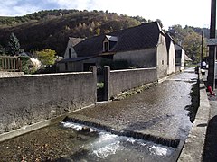 The Échez river at Les Angles
 -
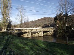 Saint-Vincent bridg, Orincles
 -
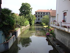 The Échez river at Maubourguet
.jpg)
.JPG)
_moulin_sur_l%27%C3%89chez.JPG)
Related pages[change | change source]
References[change | change source]
- ↑ "L'Echez (Q02-0400)" (in French). SANDRE - Portail national d'accès aux référentiels sur l'eau. Archived from the original on 2 April 2015. Retrieved 23 June 2014.
- ↑ "La Geune (Q0210570)" (in French). SANDRE - Portail national d'accès aux référentiels sur l'eau. Archived from the original on 5 March 2016. Retrieved 23 June 2014.
- ↑ "La Géline (Q0200590)" (in French). SANDRE - Portail national d'accès aux référentiels sur l'eau. Archived from the original on 5 March 2016. Retrieved 23 June 2014.
- ↑ "Le Souy (Q0220590)" (in French). SANDRE - Portail national d'accès aux référentiels sur l'eau. Archived from the original on 4 March 2016. Retrieved 23 June 2014.
- ↑ "Le Lys (Q02-0480)" (in French). SANDRE - Portail national d'accès aux référentiels sur l'eau. Archived from the original on 3 March 2016. Retrieved 23 June 2014.
- ↑ "L'Aube (Q0210520)" (in French). SANDRE - Portail national d'accès aux référentiels sur l'eau. Archived from the original on 5 March 2016. Retrieved 23 June 2014.
- ↑ "La Gespe (Q0220500)" (in French). SANDRE - Portail national d'accès aux référentiels sur l'eau. Archived from the original on 5 March 2016. Retrieved 23 June 2014.
Other websites[change | change source]
- L'adour et ses affluents, villes et villages, faune et flore, navigation et pêche Archived 2013-06-22 at the Wayback Machine (in French)