
Aruviyodu Village
Aruviyodu Village is a hilly hamlet near the river Neyyar in India. It is down south in Neyyattinkara in the district of Thiruvananthapuram.[1] It comes under Kunnathukal Panchayath. It belongs to South Kerala Division. It is located 28 kilometres (17 mi) east of the district headquarters in Thiruvananthapuram. It is 6 kilometres (3.7 mi) from Perumkadavila.
Aruviyodu is surrounded by Neyyattinkara Taluk towards the west, Parassala towards the south, Melpuram Taluk towards South, Munchira Taluk towards the south. This Place is in the border of the Thiruvananthapuram District and Kanniyakumari District.
Short Information[change | change source]
| Taluk Name | Perumkadavila |
| District | Thiruvananthapuram |
| State | Kerala |
| Division | South Kerala |
| Language | Malayalam and English, Tamil, Hindi, Tulu, Konkani |
| Code / Std Code | 0471 |
| Pin Code | 695504 |
| Post Office Name | Karakonam |
| Main Village Name | Kunnathukal |
Transportation[change | change source]
The Dhanuvachapuram Railway Station and Amaravila Halt Railway Station are near Aruviyodu. The Trivandrum Central Railway Station is major railway station 26 km from Aruviyodu.
Gallery[change | change source]
-
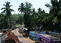
 Aruviyodu bridge
 -

-
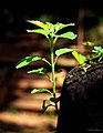 New Biginning.. From Aruviyodu
 -

-

-
 Aruviyodu


References[change | change source]
- ↑ "Aruviyodu". onefivenine.com. 2013. Retrieved 6 October 2014.