
Caernarfon
| Caernarfon | |
|---|---|
 Caernarfon Castle | |
 Caernarfon | |
| Location within Gwynedd | |
| Population | 9,852 (2011 census) |
| OS grid reference | SH485625 |
| • Cardiff | 171 miles (275 km) |
| Principal area | |
| Ceremonial county | |
| Country | Wales |
| Sovereign state | United Kingdom |
| Post town | CAERNARFON |
| Postcode district | LL54, LL55 |
| Dialling code | 01286 |
| Police | North Wales |
| Fire | North Wales |
| Ambulance | Welsh |
| UK Parliament | |
Caernarfon, officially the Caernarfon Royal Town (pronounced Kyer-narvon), is a royal town and community in Gwynedd, an area of Wales. It has a population of 9,852 people, according to the 2011 census.
It is 8.6 miles (13.8 km) south-west of the city of Bangor and 19.4 miles (31.2 km) north of Porthmadog. It is on the Menai Strait, opposite Anglesey. The A487 goes through the town.
It is a royal town. Queen Elizabeth II made Caernarfon a royal borough in 1963. Since 1974, the town has not been a borough but was allowed to keep its royal title.
The town is home to Caernarfon Castle, a castle that was built between 1283 and 1330 by order of King Edward I.
Since 2016, Caernarfon has hosted the Caernarfon Food Festival. It takes place every year.
Caernarfon has one of the highest percentages of Welsh language speakers in the whole of Wales.
Twinning[change | change source]
Caernarfon has one twin town. It is twinned with:
 Landerneau, France
Gallery[change | change source]
-
 Caernarfon Dock
 -
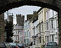 Market Street
 -
 Afon Seiont


.jpg)
| International | |
|---|---|
| National | |
| Geographic | |