
File:2010 Kansas Census Data.jpg

Size of this preview: 776 × 600 pixels. Other resolutions: 311 × 240 pixels | 621 × 480 pixels | 994 × 768 pixels | 1,280 × 989 pixels | 2,200 × 1,700 pixels.
Original file (2,200 × 1,700 pixels, file size: 238 KB, MIME type: image/jpeg)
| This is a file from the Wikimedia Commons. Information from its description page there is shown below. Commons is a freely licensed media file repository. You can help. |
Summary
| Description |
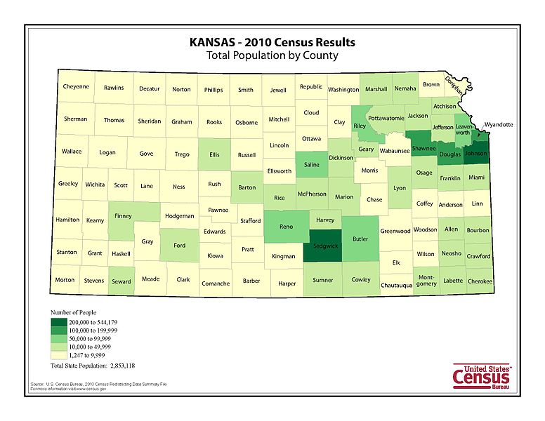
English: 2010 map showing the population density of Kansas |
| Date | |
| Source | http://2010.census.gov/news/img/cb11cn63_ks_totalpop_2010map.jpg |
| Author | US Census |
Licensing
This image or file is a work of a United States Census Bureau employee, taken or made as part of that person's official duties. As a work of the U.S. federal government, the image is in the public domain.
|
 |
File history
Click on a date/time to view the file as it appeared at that time.
| Date/Time | Thumbnail | Dimensions | User | Comment | |
|---|---|---|---|---|---|
| current | 22:05, 5 March 2011 | | 2,200 × 1,700 (238 KB) | Seattle | {{Information |Description ={{en|1=2010 map showing the population density of Kansas}} |Source =http://2010.census.gov/news/img/cb11cn63_ks_totalpop_2010map.jpg |Author =US Census |Date =March 2011 |Permission |
File usage
The following page uses this file: