
File:Afghan-big.jpg

Size of this preview: 558 × 599 pixels. Other resolutions: 223 × 240 pixels | 447 × 480 pixels | 715 × 768 pixels | 953 × 1,024 pixels | 1,378 × 1,480 pixels.
Original file (1,378 × 1,480 pixels, file size: 340 KB, MIME type: image/jpeg)
| This is a file from the Wikimedia Commons. Information from its description page there is shown below. Commons is a freely licensed media file repository. You can help. |
Summary
| Description |
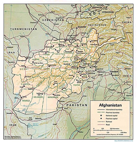
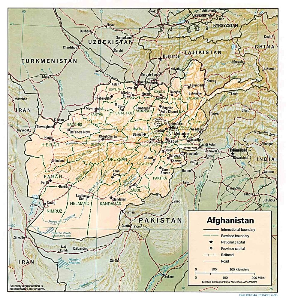
English: Map of Afghanistan |
|||||
| Date | ||||||
| Source | http://memory.loc.gov/cgi-bin/query/r?ammem/gmd:@field(NUMBER+@band(g7630+ct000721)) | |||||
| Author | United States Central Intelligence Agency | |||||
| Permission (Reusing this file) |
|
|||||
| Other versions | Derivative works of this file: Khyber Pass Area Map.jpg |


File history
Click on a date/time to view the file as it appeared at that time.
| Date/Time | Thumbnail | Dimensions | User | Comment | |
|---|---|---|---|---|---|
| current | 23:24, 16 December 2006 | | 1,378 × 1,480 (340 KB) | Electionworld | {{ew|en|Ijomer}} Map of Afghanistan *CREATED/PUBLISHED: Central Intelligence Agency, 1993 *source: http://memory.loc.gov/cgi-bin/query/r?ammem/gmd:@field(NUMBER+@band(g7630+ct000721)) {{PD-USGov-CIA}} |
File usage
The following page uses this file:
Global file usage
The following other wikis use this file:
- Usage on ar.wikipedia.org
- Usage on azb.wikipedia.org
- Usage on be.wikipedia.org
- Usage on bjn.wikipedia.org
- Usage on bn.wikipedia.org
- Usage on de.wikivoyage.org
- Usage on en.wikipedia.org
- Usage on fo.wikipedia.org
- Usage on hi.wikipedia.org
- Usage on id.wikipedia.org
- Usage on kk.wikipedia.org
- Usage on la.wikipedia.org
- Usage on ml.wikipedia.org
- Usage on ms.wikipedia.org
- Usage on pl.wikipedia.org
- Usage on ps.wikipedia.org
- Usage on ru.wikipedia.org
- Usage on sq.wikipedia.org
- Usage on uk.wikipedia.org
- Usage on uz.wikipedia.org