
File:China edcp location map.svg

Size of this PNG preview of this SVG file: 512 × 408 pixels. Other resolutions: 301 × 240 pixels | 602 × 480 pixels | 964 × 768 pixels | 1,280 × 1,020 pixels | 2,560 × 2,040 pixels.
Original file (SVG file, nominally 512 × 408 pixels, file size: 2.56 MB)
| This is a file from the Wikimedia Commons. Information from its description page there is shown below. Commons is a freely licensed media file repository. You can help. |
Summary
| Description |
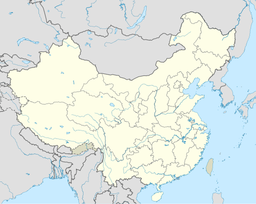
English: Location map of China.
EquiDistantConicProjection : Central parallel :
Central meridian :
Standard parallels:
Latitudes on the central meridian :
|
| Date | |
| Source | Own work |
| Author | Uwe Dedering |
| Other versions |
Derivative works of this file:
|
| SVG development | This W3C-invalid map was created with Adobe Illustrator, and with Inkscape. |

Licensing
I, the copyright holder of this work, hereby publish it under the following licenses:
This file is licensed under the Creative Commons Attribution-Share Alike 3.0 Unported license.
- You are free:
- to share – to copy, distribute and transmit the work
- to remix – to adapt the work
- Under the following conditions:
- attribution – You must give appropriate credit, provide a link to the license, and indicate if changes were made. You may do so in any reasonable manner, but not in any way that suggests the licensor endorses you or your use.
- share alike – If you remix, transform, or build upon the material, you must distribute your contributions under the same or compatible license as the original.

|
Permission is granted to copy, distribute and/or modify this document under the terms of the GNU Free Documentation License, Version 1.2 or any later version published by the Free Software Foundation; with no Invariant Sections, no Front-Cover Texts, and no Back-Cover Texts. A copy of the license is included in the section entitled GNU Free Documentation License. |
You may select the license of your choice.
File history
Click on a date/time to view the file as it appeared at that time.
| Date/Time | Thumbnail | Dimensions | User | Comment | |
|---|---|---|---|---|---|
| current | 04:10, 13 December 2021 | | 512 × 408 (2.56 MB) | Maanshen | Update borders and land reclamation. |
| 02:44, 31 October 2021 |  | 512 × 408 (2.54 MB) | Not logging in | Fix colored path shown as land in XInjiang and Gansu. | |
| 02:41, 31 October 2021 |  | 512 × 408 (2.54 MB) | Not logging in | FIx | |
| 02:35, 31 October 2021 |  | 512 × 408 (2.54 MB) | Not logging in | Corrected borders for Xinjiang, Qinghai, and Gansu provincial borders per request, see NordNordWest's talk page | |
| 12:32, 29 March 2021 |  | 512 × 408 (2.36 MB) | 瑞丽江的河水 | Reverted to version as of 09:13, 22 February 2021 (UTC), disputed area, special color | |
| 07:40, 29 March 2021 |  | 1,181 × 940 (4.07 MB) | Turbo Slayer 2021 | Reverted to version as of 02:23, 28 March 2021 (UTC)Firstly, Taiwan is not a part of China cause the Government of Taiwan is Republic of China. Southern Tibet is a part of India not China. That's all | |
| 14:08, 28 March 2021 |  | 512 × 408 (2.36 MB) | 瑞丽江的河水 | Reverted to version as of 09:13, 22 February 2021 (UTC) | |
| 02:23, 28 March 2021 |  | 1,181 × 940 (4.07 MB) | Turbo Slayer 2021 | Reverted to version as of 20:14, 31 August 2011 (UTC) | |
| 09:13, 22 February 2021 |  | 512 × 408 (2.36 MB) | DokiDonkey | Fix | |
| 09:23, 19 February 2021 |  | 512 × 408 (2.34 MB) | DokiDonkey | Change Trans-Karakoram Tract |
File usage
The following 23 pages use this file:
- 2023 Yinchuan gas explosion
- Beijing Capital International Airport
- Cao'an
- Changqing Subdistrict
- Daocheng Yading Airport
- Dongguan
- Hankou railway station
- Hefei
- Jiashan County
- Kunming
- Lanzhou
- List of World Heritage Sites in China
- List of cities in China by population
- Longyan
- Nanjing
- Shangzhou District
- Shenzhen
- Suzhou
- Temple of Confucius, Qufu
- Xi'an
- Xiamen
- Module:Location map/data/China
- Module:Location map/data/China/doc
Global file usage
The following other wikis use this file:
- Usage on ace.wikipedia.org
- Usage on af.wikipedia.org
- Nanjing
- Groot Muur van China
- Sjabloon:Liggingkaart Volksrepubliek China
- Shangqiu
- Dongguan
- Wenzhou
- Zibo
- Suzhou, Jiangsu
- Kaifeng
- Qingdao
- Xiamen
- Shantou
- Wuxi
- Quanzhou
- Shijiazhuang
- Changsha
- Hefei
- Kunming
- Tangshan
- Ningbo
- Fuzhou
- Changzhou
- Taizhou, Zhejiang
- Ürümqi
- Guiyang
- Xuzhou
- Nanchang
- Lanzhou
- Anshan
- Yangzhou
- Nantong
- Hohhot
- Jilin (stad)
- Huainan
- Linyi
- Xiangtan
- Huizhou
- Baotou
- Nanyang
- Baoding
- Liuzhou
- Tai'an
- Fuyang
- Jiangmen
- Yinchuan
- Weifang
- Zhuhai
- Huangshi
View more global usage of this file.