
File:Dr-map.gif
No higher resolution available.
Dr-map.gif (326 × 350 pixels, file size: 10 KB, MIME type: image/gif)
| This is a file from the Wikimedia Commons. Information from its description page there is shown below. Commons is a freely licensed media file repository. You can help. |
| Description |
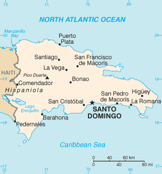
English: Locator map of Dominican Republic. |
| Source | CIA World Factbook |
| Author | Original uploader was User:Dubaduba~commonswiki |
| Other versions |
|


|
This locator map image could be re-created using vector graphics as an SVG file. This has several advantages; see Commons:Media for cleanup for more information. If an SVG form of this image is available, please upload it and afterwards replace this template with
{{vector version available|new image name}}.
It is recommended to name the SVG file “Dr-map.svg”—then the template Vector version available (or Vva) does not need the new image name parameter. |
This image is in the public domain because it contains materials that originally came from the United States Central Intelligence Agency's World Factbook.
|
 |
File history
Click on a date/time to view the file as it appeared at that time.
| Date/Time | Thumbnail | Dimensions | User | Comment | |
|---|---|---|---|---|---|
| current | 22:04, 16 June 2013 | | 326 × 350 (10 KB) | Ras67 | cropped |
| 17:59, 12 June 2005 |  | 328 × 353 (11 KB) | Dubaduba~commonswiki | {{PD-USGov-CIA-WF}} |
File usage
The following page uses this file:
Global file usage
The following other wikis use this file:
- Usage on als.wikipedia.org
- Usage on ar.wikipedia.org
- Usage on ast.wikipedia.org
- Usage on avk.wikipedia.org
- Usage on az.wikipedia.org
- Usage on bs.wikipedia.org
- Usage on ca.wikipedia.org
- Usage on da.wikipedia.org
- Usage on en.wikipedia.org
- Politics of the Dominican Republic
- List of cities in the Dominican Republic
- Ecclesiastical provinces and dioceses of the Episcopal Church
- Water supply and sanitation in the Dominican Republic
- Water resources management in the Dominican Republic
- Irrigation in the Dominican Republic
- User:Anunezsanchez/Gestion de Recursos Hidricos en Colombia
- Episcopal Diocese of the Dominican Republic
- Usage on es.wikipedia.org
- Usage on fa.wikipedia.org
- Usage on fi.wikipedia.org
- Usage on fo.wikipedia.org
- Usage on fr.wikipedia.org
- Usage on gd.wikipedia.org
- Usage on gl.wikipedia.org
- Usage on hr.wikipedia.org
- Usage on io.wikipedia.org
- Usage on it.wikipedia.org
- Usage on ja.wikipedia.org
- Usage on ku.wikipedia.org
- Usage on kw.wikipedia.org
- Usage on lfn.wikipedia.org
- Usage on lt.wikipedia.org
- Usage on ml.wikipedia.org
- Usage on mt.wikipedia.org
- Usage on pt.wikipedia.org
- Usage on ru.wikipedia.org
View more global usage of this file.