
File:Gulf of Finland OnEarth WMS.png

Size of this preview: 800 × 369 pixels. Other resolutions: 320 × 148 pixels | 640 × 295 pixels | 1,024 × 473 pixels | 1,280 × 591 pixels | 3,840 × 1,772 pixels.
Original file (3,840 × 1,772 pixels, file size: 8.37 MB, MIME type: image/png)
| This is a file from the Wikimedia Commons. Information from its description page there is shown below. Commons is a freely licensed media file repository. You can help. |
|Description=
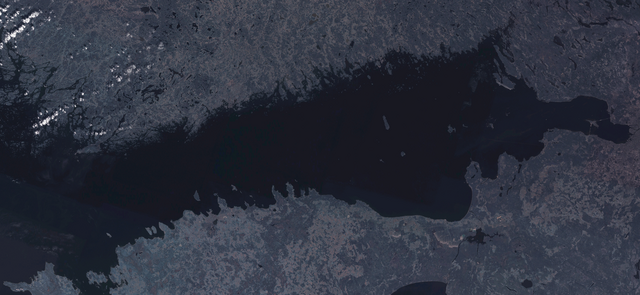
English: Satellite image of Gulf of Finland.
Русский: Финский залив.
Suomi: Suomenlahti.
Eesti: Soome laht.
Svenska: Finska viken.
Deutsch: Finnische Meerbusen.
| This image is in the public domain because it is a screenshot from NASA’s globe software World Wind using a public domain layer, such as Blue Marble, MODIS, Landsat, SRTM, USGS or GLOBE.
|
 |
Image captured from NASA World Wind, OnEarth WMS global mosaic visual layer.
File history
Click on a date/time to view the file as it appeared at that time.
| Date/Time | Thumbnail | Dimensions | User | Comment | |
|---|---|---|---|---|---|
| current | 11:14, 6 October 2006 | | 3,840 × 1,772 (8.37 MB) | Hautala | {{PD-WorldWind}} Satellite image of Gulf of Finland. Image captured from NASA World Wind, OnEarth WMS global mosaic visual layer. Category:Gulf of Finland |
File usage
The following page uses this file:
Global file usage
The following other wikis use this file:
- Usage on bs.wikipedia.org
- Usage on da.wikipedia.org
- Usage on se.wikipedia.org
- Usage on sv.wikipedia.org