
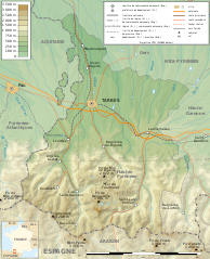
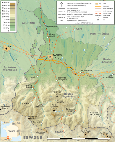
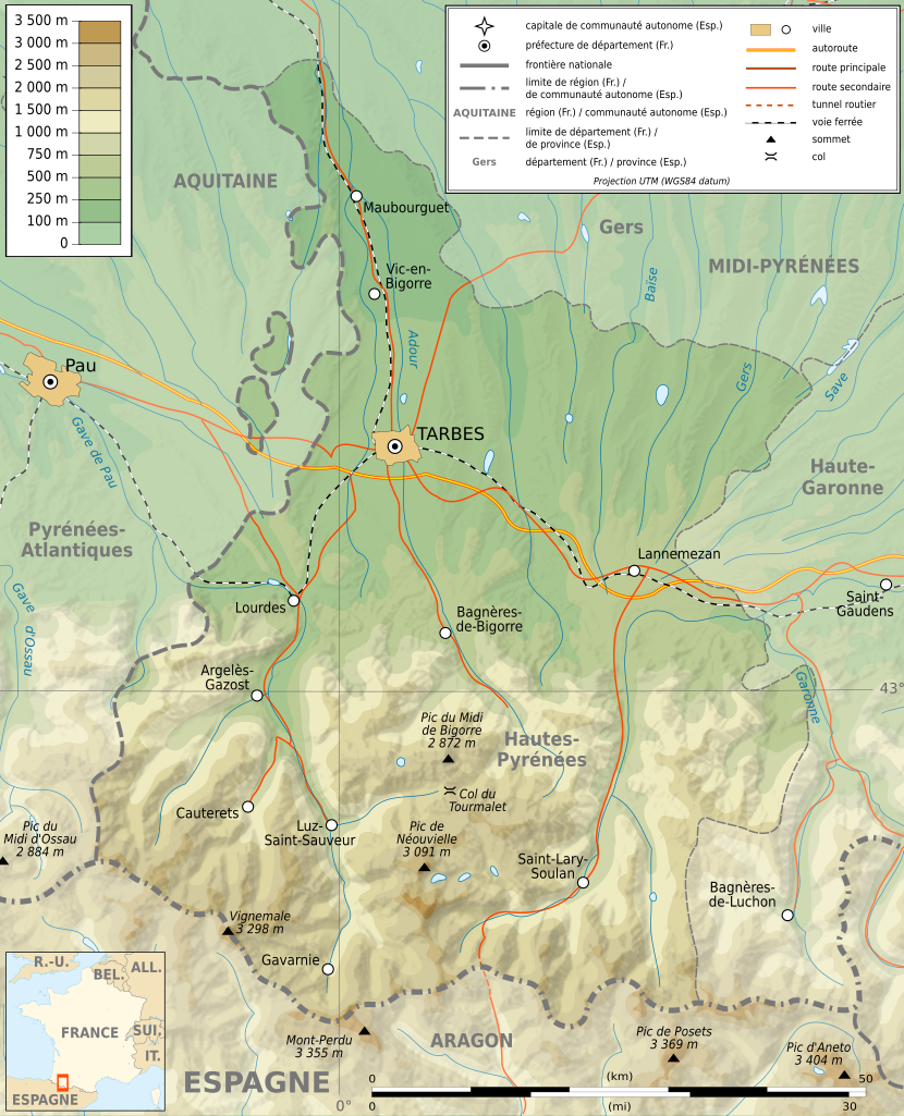
File:Hautes Pyrenees topographic map-fr.svg

Size of this PNG preview of this SVG file: 486 × 600 pixels. Other resolutions: 194 × 240 pixels | 389 × 480 pixels | 622 × 768 pixels | 830 × 1,024 pixels | 1,659 × 2,048 pixels | 1,132 × 1,397 pixels.
Original file (SVG file, nominally 1,132 × 1,397 pixels, file size: 605 KB)
| This is a file from the Wikimedia Commons. Information from its description page there is shown below. Commons is a freely licensed media file repository. You can help. |
Summary
| Description |
English: Topographic map in French of the department of the Hautes-Pyrénées Français : Carte topographique en français du département des Hautes-Pyrénées |
| Date | |
| Source |
English: Extract from Image:Pyrenees topographic map-fr.svg and Image:Pyrenees map shaded relief-fr.svg by Sting.
Français : Extrait de Image:Pyrenees topographic map-fr.svg et Image:Pyrenees map shaded relief-fr.svg par Sting.
|
| Author | Sémhur ; author of the original map : Eric Gaba (Sting - fr:Sting) |
| Permission (Reusing this file) |
GFDL / Attribution and Share-Alike required |
| Other versions |
|

| Camera location | | View this and other nearby images on: OpenStreetMap |
|---|

|
This SVG file contains embedded text that can be translated into your language, using any capable SVG editor, text editor or the SVG Translate tool. For more information see: About translating SVG files. |
Licensing
I, the copyright holder of this work, hereby publish it under the following licenses:

|
Permission is granted to copy, distribute and/or modify this document under the terms of the GNU Free Documentation License, Version 1.2 or any later version published by the Free Software Foundation; with no Invariant Sections, no Front-Cover Texts, and no Back-Cover Texts. A copy of the license is included in the section entitled GNU Free Documentation License. |
This file is licensed under the Creative Commons Attribution-Share Alike 4.0 International, 3.0 Unported, 2.5 Generic, 2.0 Generic and 1.0 Generic license.
- You are free:
- to share – to copy, distribute and transmit the work
- to remix – to adapt the work
- Under the following conditions:
- attribution – You must give appropriate credit, provide a link to the license, and indicate if changes were made. You may do so in any reasonable manner, but not in any way that suggests the licensor endorses you or your use.
- share alike – If you remix, transform, or build upon the material, you must distribute your contributions under the same or compatible license as the original.
You may select the license of your choice.
File history
Click on a date/time to view the file as it appeared at that time.
| Date/Time | Thumbnail | Dimensions | User | Comment | |
|---|---|---|---|---|---|
| current | 06:55, 16 February 2009 | | 1,132 × 1,397 (605 KB) | Hektor | |
| 16:11, 16 July 2008 |  | 1,132 × 1,397 (573 KB) | Sémhur | == Summary == {{Location dec|43|0.15|type:adm2nd_region:FR-MP_scale:1000000}} <br/> {{Information |Description={{en|Topographic map in French of the department of the Hautes-Pyrénées}}{{fr|Carte topographique en français du d� |
File usage
The following page uses this file:
Global file usage
The following other wikis use this file:
- Usage on br.wikipedia.org
- Usage on ca.wikipedia.org
- Usage on de.wikipedia.org
- Usage on el.wikipedia.org
- Usage on en.wikipedia.org
- Usage on eu.wikipedia.org
- Usage on fr.wikipedia.org
- Usage on hu.wikipedia.org
- Usage on ja.wikipedia.org
- Usage on sq.wikipedia.org