
File:Kryžių kalnas (Góra Krzyży).JPG
Size of this preview: 800 × 289 pixels. Other resolutions: 320 × 116 pixels | 640 × 231 pixels | 1,024 × 370 pixels | 1,280 × 462 pixels | 5,539 × 2,000 pixels.
Original file (5,539 × 2,000 pixels, file size: 7.52 MB, MIME type: image/jpeg)
| This is a file from the Wikimedia Commons. Information from its description page there is shown below. Commons is a freely licensed media file repository. You can help. |
.JPG)
|
.JPG)
This image was selected as picture of the day on Wikimedia Commons for 22 April 2012. It was captioned as follows:
|
Summary
| Description |
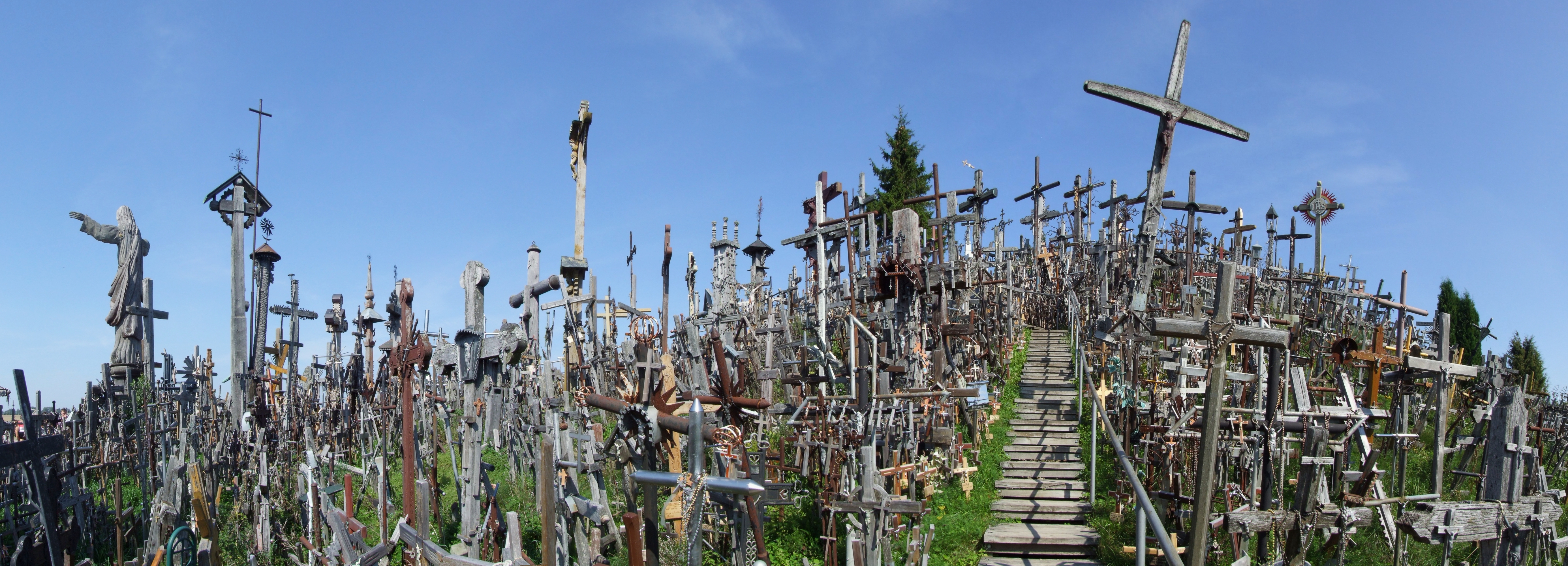
English: Hill of Crosses (Kryžių kalnas) Français : La colline des Croix, Lituanie Русский: Гора Крестов, окрестности Шауляя, Литва |
|
| Date | ||
| Source | Own work | |
| Author | Pudelek (Marcin Szala) | |
| Other versions |
Derivative works of this file: Kryžių kalnas banner.jpg
|
| Camera location | | View this and other nearby images on: OpenStreetMap |
|---|
.JPG¶ms=056.015286_N_0023.416289_E_globe:Earth_type:camera__&language=en)
Licensing
I, the copyright holder of this work, hereby publish it under the following license:
This file is licensed under the Creative Commons Attribution-Share Alike 3.0 Unported license.
- You are free:
- to share – to copy, distribute and transmit the work
- to remix – to adapt the work
- Under the following conditions:
- attribution – You must give appropriate credit, provide a link to the license, and indicate if changes were made. You may do so in any reasonable manner, but not in any way that suggests the licensor endorses you or your use.
- share alike – If you remix, transform, or build upon the material, you must distribute your contributions under the same or compatible license as the original.
File history
Click on a date/time to view the file as it appeared at that time.
| Date/Time | Thumbnail | Dimensions | User | Comment | |
|---|---|---|---|---|---|
| current | 11:50, 29 March 2012 | 5,539 × 2,000 (7.52 MB) | Pudelek | m.e. | |
| 19:48, 25 October 2011 | 5,539 × 2,000 (6.85 MB) | Pudelek | {{Information |Description ={{en|1=Hill of Crosses (Kryžių kalnas) }} |Source ={{own}} |Author =Pudelek (Marcin Szala) |Date =2011-08 |Permission = |other_versions = }} Category:Hill of Crosses [[Ca |
File usage
The following page uses this file:
Global file usage
The following other wikis use this file:
- Usage on af.wikipedia.org
- Usage on az.wikipedia.org
- Usage on ba.wikipedia.org
- Usage on be-tarask.wikipedia.org
- Usage on bn.wikipedia.org
- Usage on ca.wikipedia.org
- Usage on crh.wikipedia.org
- Usage on cs.wikipedia.org
- Usage on cv.wikipedia.org
- Usage on cy.wikipedia.org
- Usage on de.wikipedia.org
- Usage on el.wikipedia.org
- Usage on en.wikipedia.org
- Usage on eo.wikipedia.org
- Usage on et.wikipedia.org
- Usage on fa.wikipedia.org
- Usage on fi.wikipedia.org
- Usage on fr.wikipedia.org
- Usage on hu.wikipedia.org
- Usage on it.wikipedia.org
- Usage on ka.wikipedia.org
- Usage on kk.wikipedia.org
- Usage on ko.wikipedia.org
- Usage on krc.wikipedia.org
- Usage on kw.wikipedia.org
- Usage on lbe.wikipedia.org
- Usage on lt.wikipedia.org
- Usage on nl.wikipedia.org
- Usage on no.wikipedia.org
- Usage on os.wikipedia.org
- Usage on pt.wikipedia.org
- Usage on ru.wikipedia.org
- Usage on ru.wikinews.org
- Usage on sah.wikipedia.org
- Usage on sl.wikipedia.org
- Usage on ta.wikipedia.org
- Usage on uk.wikipedia.org
View more global usage of this file.
.JPG)
.JPG)