
File:Linkinhorne Parish Church - geograph.org.uk - 404867.jpg
Size of this preview: 403 × 600 pixels. Other resolutions: 161 × 240 pixels | 430 × 640 pixels.
Original file (430 × 640 pixels, file size: 87 KB, MIME type: image/jpeg)
| This is a file from the Wikimedia Commons. Information from its description page there is shown below. Commons is a freely licensed media file repository. You can help. |
Summary
| Description |
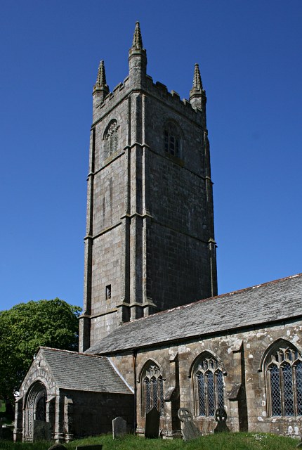
English: Linkinhorne Parish Church This church has a very tall four stage tower. It is dedicated to St Mellor. The church does not sit in a substantial village but in a "Churchtown" which is really a hamlet. |
| Date | |
| Source | From geograph.org.uk |
| Author | Tony Atkin |
| Attribution (required by the license) | Tony Atkin / Linkinhorne Parish Church / |
| Camera location | | View this and other nearby images on: OpenStreetMap |
|---|
_heading:315.00&language=en)
| Object location | | View this and other nearby images on: OpenStreetMap |
|---|
_heading:315.00&language=en)
Licensing

|
This image was taken from the Geograph project collection. See this photograph's page on the Geograph website for the photographer's contact details. The copyright on this image is owned by Tony Atkin and is licensed for reuse under the Creative Commons Attribution-ShareAlike 2.0 license.
|
This file is licensed under the Creative Commons Attribution-Share Alike 2.0 Generic license.
Attribution: Tony Atkin
- You are free:
- to share – to copy, distribute and transmit the work
- to remix – to adapt the work
- Under the following conditions:
- attribution – You must give appropriate credit, provide a link to the license, and indicate if changes were made. You may do so in any reasonable manner, but not in any way that suggests the licensor endorses you or your use.
- share alike – If you remix, transform, or build upon the material, you must distribute your contributions under the same or compatible license as the original.
File history
Click on a date/time to view the file as it appeared at that time.
| Date/Time | Thumbnail | Dimensions | User | Comment | |
|---|---|---|---|---|---|
| current | 04:47, 29 December 2011 | | 430 × 640 (87 KB) | Rotatebot | Bot: Reset EXIF-specified Orientation of image (EXIF-Orientation set from 8 to 1, rotated 0°) |
| 22:00, 3 February 2011 |  | 640 × 430 (87 KB) | GeographBot | == {{int:filedesc}} == {{Information |description={{en|1=Linkinhorne Parish Church This church has a very tall four stage tower. It is dedicated to St Mellor. The church does not sit in a substantial village but in a "Churchtown" which is really a hamle |
File usage
The following page uses this file:
Global file usage
The following other wikis use this file:
- Usage on ceb.wikipedia.org
- Usage on cy.wikipedia.org
- Usage on dag.wikipedia.org
- Usage on en.wikipedia.org
- Usage on eu.wikipedia.org
- Usage on fr.wikipedia.org
- Usage on lld.wikipedia.org
- Usage on pl.wikipedia.org
- Usage on sv.wikipedia.org
- Usage on www.wikidata.org
- Usage on zh-min-nan.wikipedia.org