
File:Localización de Andalucía.svg

Size of this PNG preview of this SVG file: 686 × 518 pixels. Other resolutions: 318 × 240 pixels | 636 × 480 pixels | 1,017 × 768 pixels | 1,280 × 967 pixels | 2,560 × 1,933 pixels.
Original file (SVG file, nominally 686 × 518 pixels, file size: 502 KB)
| This is a file from the Wikimedia Commons. Information from its description page there is shown below. Commons is a freely licensed media file repository. You can help. |
Summary
| Description |
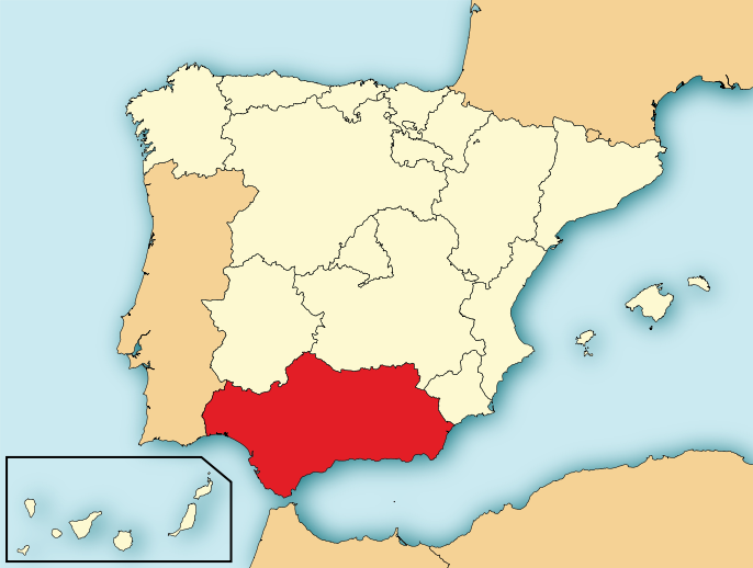
English: Map of Spain with Andalusia highlighted. Español: Localización de Andalucía respecto a España. |
| Date | |
| Source | File:EspañaLoc.svg, de HansenBCN. Modificada por User:Mutxamel. |
| Author | Mutxamel, subido por Rastrojo •ES) |
| Other versions |
Derivative works of this file: |
| SVG development | This locator map was created with Adobe Illustrator. |

Licensing
I, the copyright holder of this work, hereby publish it under the following licenses:

|
Permission is granted to copy, distribute and/or modify this document under the terms of the GNU Free Documentation License, Version 1.2 or any later version published by the Free Software Foundation; with no Invariant Sections, no Front-Cover Texts, and no Back-Cover Texts. A copy of the license is included in the section entitled GNU Free Documentation License. |
This file is licensed under the Creative Commons Attribution-Share Alike 4.0 International, 3.0 Unported, 2.5 Generic, 2.0 Generic and 1.0 Generic license.
- You are free:
- to share – to copy, distribute and transmit the work
- to remix – to adapt the work
- Under the following conditions:
- attribution – You must give appropriate credit, provide a link to the license, and indicate if changes were made. You may do so in any reasonable manner, but not in any way that suggests the licensor endorses you or your use.
- share alike – If you remix, transform, or build upon the material, you must distribute your contributions under the same or compatible license as the original.
You may select the license of your choice.
File history
Click on a date/time to view the file as it appeared at that time.
| Date/Time | Thumbnail | Dimensions | User | Comment | |
|---|---|---|---|---|---|
| current | 19:21, 4 August 2010 | | 686 × 518 (502 KB) | Orionist | removed border and artifacts, various other fixes |
| 11:00, 6 July 2009 |  | 690 × 522 (562 KB) | Rastrojo | nueva versión | |
| 18:31, 2 April 2008 |  | 578 × 374 (407 KB) | Paintman | Color verde y por comunidades autónomas. | |
| 19:52, 7 January 2008 |  | 578 × 374 (608 KB) | Rastrojo | {{Information |Description= Localización de Andalucía respecto a España |Source= Image:Provincias de España centrado.svg |Date= |Author= Rastrojo |Permission= |other_versions= }} [[Category:Maps of Spai |
File usage
There are no pages that use this file.
Global file usage
The following other wikis use this file:
- Usage on ace.wikipedia.org
- Usage on af.wikipedia.org
- Usage on als.wikipedia.org
- Usage on an.wikipedia.org
- Usage on ar.wikipedia.org
- Usage on arz.wikipedia.org
- Usage on ast.wikipedia.org
- Usage on ast.wiktionary.org
- Usage on ay.wikipedia.org
- Usage on az.wikipedia.org
- Usage on be-tarask.wikipedia.org
- Usage on be.wikipedia.org
- Usage on bg.wikipedia.org
- Usage on br.wikipedia.org
- Usage on br.wiktionary.org
- Usage on ca.wikipedia.org
- Usage on ceb.wikipedia.org
- Usage on crh.wikipedia.org
- Usage on cs.wikipedia.org
- Usage on da.wikipedia.org
- Usage on de.wikipedia.org
- Usage on de.wikivoyage.org
- Usage on diq.wikipedia.org
- Usage on el.wikipedia.org
- Usage on el.wiktionary.org
- Usage on en.wikipedia.org
- Usage on en.wiktionary.org
- Usage on eo.wikipedia.org
- Usage on eo.wiktionary.org
- Usage on es.wikipedia.org
View more global usage of this file.