
File:Map of Montana highlighting Lewis and Clark County.svg

Size of this PNG preview of this SVG file: 800 × 461 pixels. Other resolutions: 320 × 185 pixels | 640 × 369 pixels | 1,024 × 591 pixels | 1,280 × 738 pixels | 2,560 × 1,477 pixels | 9,194 × 5,303 pixels.
Original file (SVG file, nominally 9,194 × 5,303 pixels, file size: 122 KB)
| This is a file from the Wikimedia Commons. Information from its description page there is shown below. Commons is a freely licensed media file repository. You can help. |
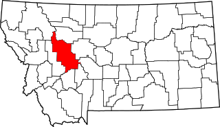
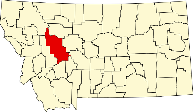
This is a locator map showing Lewis and Clark County in Montana.
| I, the copyright holder of this work, release this work into the public domain. This applies worldwide. In some countries this may not be legally possible; if so: I grant anyone the right to use this work for any purpose, without any conditions, unless such conditions are required by law. |
File history
Click on a date/time to view the file as it appeared at that time.
| Date/Time | Thumbnail | Dimensions | User | Comment | |
|---|---|---|---|---|---|
| current | 13:30, 12 February 2006 | | 9,194 × 5,303 (122 KB) | David Benbennick | {{subst:User:Dbenbenn/clm|county=Lewis and Clark County|state=Montana|type=county}} |
File usage
The following 2 pages use this file:
Global file usage
The following other wikis use this file:
- Usage on ar.wikipedia.org
- Usage on bg.wikipedia.org
- Usage on bpy.wikipedia.org
- Usage on cdo.wikipedia.org
- Usage on ceb.wikipedia.org
- Usage on cy.wikipedia.org
- Usage on de.wikipedia.org
- Usage on en.wikipedia.org
- Helena, Montana
- List of counties in Montana
- Lewis and Clark County, Montana
- Augusta, Montana
- East Helena, Montana
- Helena Valley Northeast, Montana
- Helena Valley Northwest, Montana
- Helena Valley Southeast, Montana
- Helena Valley West Central, Montana
- Lincoln, Montana
- Helena West Side, Montana
- Marysville, Montana
- MacDonald Pass
- Rogers Pass (Montana)
- User:Nyttend/County templates/MT
- Template:Lewis and Clark County, Montana
- National Register of Historic Places listings in Lewis and Clark County, Montana
- Wolf Creek, Montana
- Craig, Montana
- List of lakes of Lewis and Clark County, Montana
- List of mountains in Lewis and Clark County, Montana
- Category:Populated places in Lewis and Clark County, Montana
- List of trails of Lewis and Clark County, Montana
- Rimini, Montana
- Unionville, Montana
- Canyon Creek, Montana
- Cadotte Pass
- Mike Horse, Montana
- Milford Colony, Montana
- Gilman, Montana
- York, Montana
View more global usage of this file.