
File:Map of Tennessee highlighting Perry County.svg

Size of this PNG preview of this SVG file: 800 × 196 pixels. Other resolutions: 320 × 78 pixels | 640 × 157 pixels | 1,024 × 251 pixels | 1,280 × 314 pixels | 2,560 × 628 pixels | 7,814 × 1,916 pixels.
Original file (SVG file, nominally 7,814 × 1,916 pixels, file size: 98 KB)
| This is a file from the Wikimedia Commons. Information from its description page there is shown below. Commons is a freely licensed media file repository. You can help. |
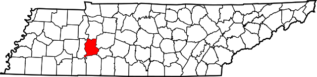
| Description | This is a locator map showing Perry County in Tennessee. For more information, see Commons:United States county locator maps. | ||
| Date | |||
| Source | Public domain map courtesy of The General Libraries, The University of Texas at Austin, modified to show counties. See en:Wikipedia:U.S. county maps. | ||
| Author | David Benbennick made this map. | ||
| Permission (Reusing this file) |
|
File history
Click on a date/time to view the file as it appeared at that time.
| Date/Time | Thumbnail | Dimensions | User | Comment | |
|---|---|---|---|---|---|
| current | 16:34, 12 February 2006 | 7,814 × 1,916 (98 KB) | David Benbennick | {{subst:User:Dbenbenn/clm|county=Perry County|state=Tennessee|type=county}} |
File usage
The following page uses this file:
Global file usage
The following other wikis use this file:
- Usage on ar.wikipedia.org
- Usage on bg.wikipedia.org
- Usage on bpy.wikipedia.org
- Usage on cdo.wikipedia.org
- Usage on ceb.wikipedia.org
- Usage on ce.wikipedia.org
- Usage on cy.wikipedia.org
- Usage on de.wikipedia.org
- Usage on en.wikipedia.org
- Perry County, Tennessee
- Chestnut Grove, Tennessee
- Flat Woods, Tennessee
- Pine View, Tennessee
- List of counties in Tennessee
- Mousetail Landing State Park
- Bunker Hill, Tennessee
- Spring Creek, Perry County, Tennessee
- Template:PerryCountyTN-geo-stub
- Beardstown, Tennessee
- Bethel, Perry County, Tennessee
- DePriest Bend, Tennessee
- Pope, Tennessee
- Usage on es.wikipedia.org
- Usage on eu.wikipedia.org
- Usage on fa.wikipedia.org
- Usage on frr.wikipedia.org
- Usage on fr.wikipedia.org
- Usage on ga.wikipedia.org
- Usage on hu.wikipedia.org
- Usage on hy.wikipedia.org
- Usage on it.wikipedia.org
- Usage on ja.wikipedia.org
- Usage on ko.wikipedia.org
- Usage on la.wikipedia.org
- Usage on nds.wikipedia.org
- Usage on nl.wikipedia.org
- Usage on pl.wikipedia.org
- Usage on pnb.wikipedia.org
View more global usage of this file.