
File:NUTS 3 regions EU-27.svg

Size of this PNG preview of this SVG file: 603 × 599 pixels. Other resolutions: 242 × 240 pixels | 483 × 480 pixels | 773 × 768 pixels | 1,031 × 1,024 pixels | 2,062 × 2,048 pixels | 762 × 757 pixels.
Original file (SVG file, nominally 762 × 757 pixels, file size: 3.38 MB)
| This is a file from the Wikimedia Commons. Information from its description page there is shown below. Commons is a freely licensed media file repository. You can help. |
Summary
| Description |
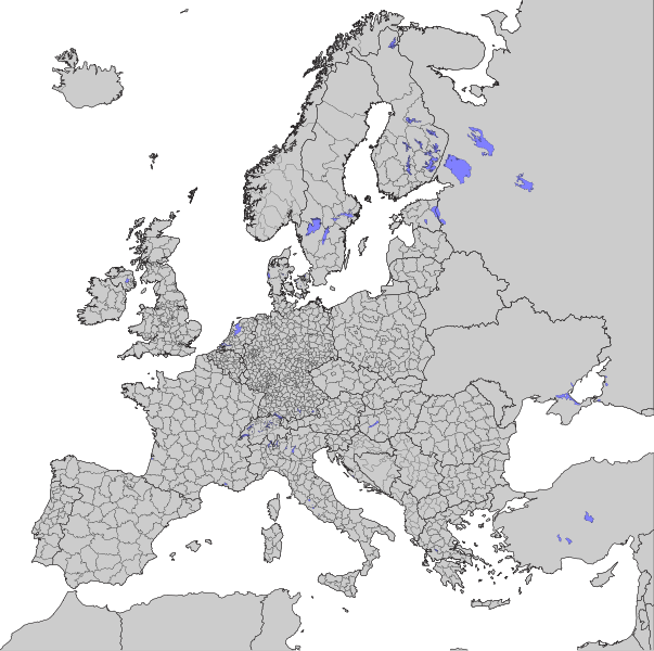
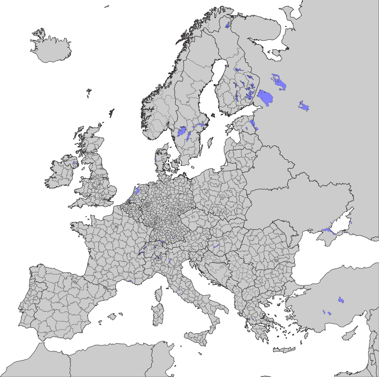
English: Map of the European Union NUTS 3 regions, 2007
Deutsch: Karte der NUTS 3 Regionen der Europäische Union, 2007 |
| Date | |
| Source | http://epp.eurostat.ec.europa.eu/portal/page/portal/gisco/maps_posters/maps |
| Author | own |
| Permission (Reusing this file) |
I, the copyright holder of this work, hereby publish it under the following license: This file is licensed under the Creative Commons Attribution-Share Alike 2.5 Generic license.
|
| Other versions |
|
| SVG development |


File history
Click on a date/time to view the file as it appeared at that time.
| Date/Time | Thumbnail | Dimensions | User | Comment | |
|---|---|---|---|---|---|
| current | 13:40, 6 January 2021 | | 762 × 757 (3.38 MB) | Lorec10 | added new countries' NUTS |
| 07:32, 8 March 2020 |  | 714 × 830 (3.6 MB) | Dziban303 | Removed lakes from Ukraine, Turkey, Switzerland and Russia. Recolored non-EU states with the exception of UK as I don't know what's going on with its NUTS. | |
| 01:50, 12 June 2010 |  | 762 × 757 (4.26 MB) | Jolly Janner | Removed criss-crossing on bodies of water in Scandanavia. Added IDs and labels to all the NUTS 3 areas to enable Ctrl + F for easier locating. Neater crop of page. Black borders between NUTS 3 areas. | |
| 12:18, 29 April 2010 |  | 705 × 715 (3.81 MB) | CGN2010 | == Summary == {{Information |Description= {{en|1=map of the European Union NUTS 3 regions, 2007}} {{de|1=Karte der NUTS 3 Regionen der Europäische Union, 2007}} |Source=http://epp.eurostat.ec.europa.eu/portal/page/portal/gisco/maps_posters/maps |
File usage
The following page uses this file:
Global file usage
The following other wikis use this file:
- Usage on ast.wikipedia.org
- Usage on az.wikipedia.org
- Usage on bg.wikipedia.org
- Usage on bs.wikipedia.org
- Usage on de.wikipedia.org
- Usage on de.wikiversity.org
- Benutzerin:Gudrun Sigrid Marko/Arbeitsseite
- Kurs:Europaforum Wachau 2017, Bürgernähe in Europa (SS 2017)/Leistungsbilanz
- Kurs:Europaforum Wachau
- Kurs:Europaforum Wachau/Artikel
- Projekt:Wikiversity Austria/Europa-Forum Wachau
- Kurs:Europa-Forum Wachau (SS 2021)/Leistungsbilanz
- Kurs:Europaforum Wachau (SS 2020)/Leistungsbilanz
- Usage on el.wikipedia.org
- Usage on es.wikipedia.org
- Usage on et.wikipedia.org
- Usage on fa.wikipedia.org
- Usage on fi.wikipedia.org
- Usage on fr.wikipedia.org
- Usage on gl.wikipedia.org
- Usage on gv.wikipedia.org
- Usage on hr.wikipedia.org
- Usage on hu.wikipedia.org
- Usage on it.wikipedia.org
- Usage on ja.wikipedia.org
- Usage on ko.wikipedia.org
- Usage on lt.wikipedia.org
- Usage on mk.wikipedia.org
- Usage on pl.wikipedia.org
- Usage on pnb.wikipedia.org
- Usage on pt.wikipedia.org
- Usage on ru.wikipedia.org
- Usage on sh.wikipedia.org
- Usage on sk.wikipedia.org
- Usage on sr.wikipedia.org
- Usage on sv.wikipedia.org
- Usage on uk.wikipedia.org
- Usage on ur.wikipedia.org