
File:Nabta-Egypt NL.jpg
Size of this preview: 562 × 600 pixels. Other resolutions: 225 × 240 pixels | 450 × 480 pixels | 720 × 768 pixels | 1,190 × 1,270 pixels.
Original file (1,190 × 1,270 pixels, file size: 660 KB, MIME type: image/jpeg)
| This is a file from the Wikimedia Commons. Information from its description page there is shown below. Commons is a freely licensed media file repository. You can help. |
Summary
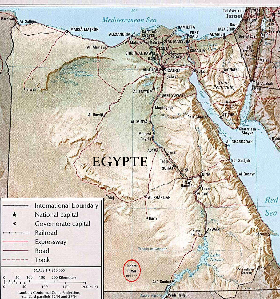
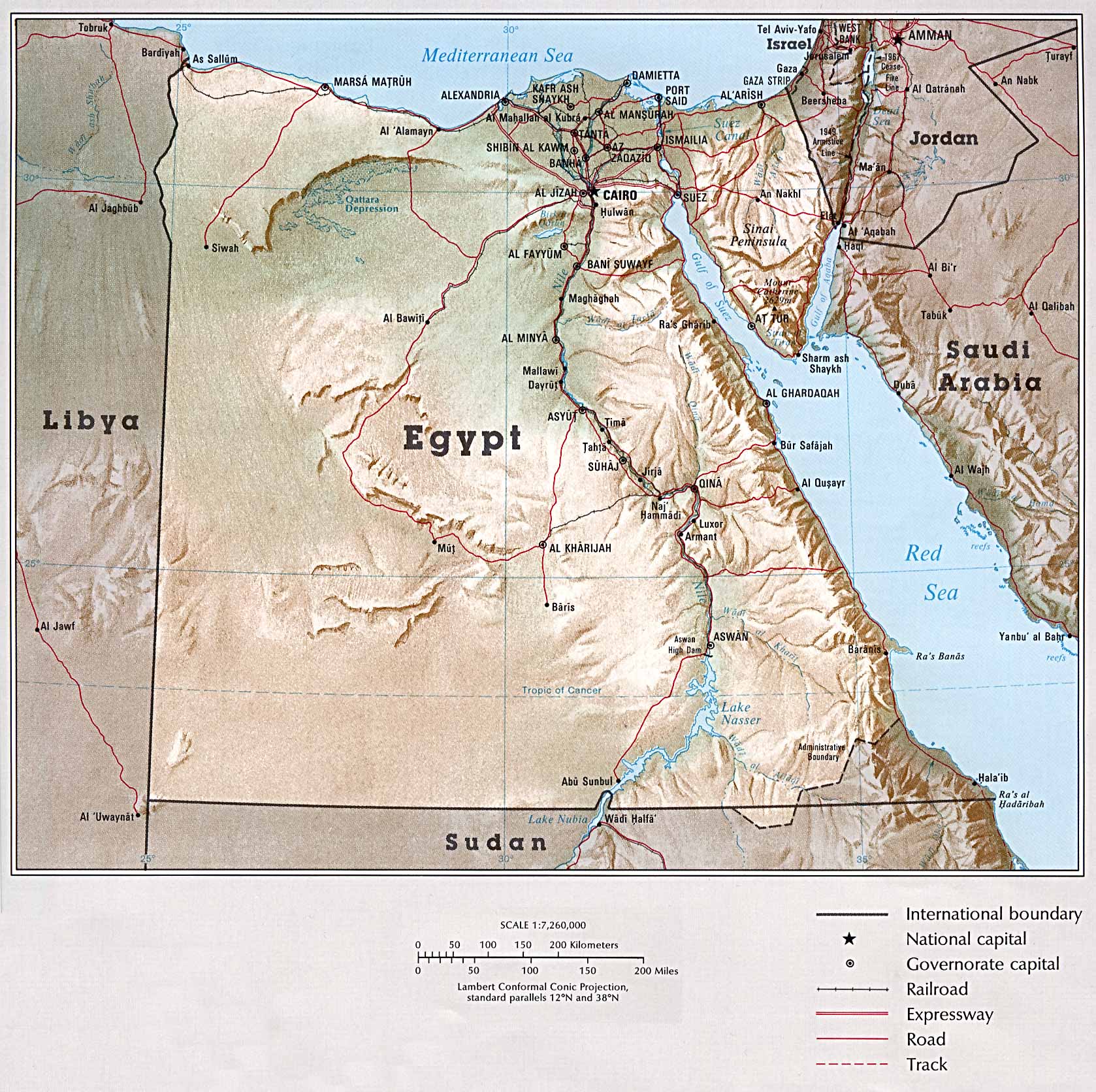
Dutch version of Public Domain Map, permission granted here, by the University of Texas at Austin.
Source: Map from The University of Texas at Austin: Egypt: Country Map.
Map reduced in size, and "Legend" and "Scale" moved up, to conserve space. Also approximate position of Nabta Playa noted: Latitude 22° 32' 00" North; Longitude 30° 42' 00" East. Subsequently translated to Dutch from the aforementioned source from English Wikipedia.
Licensing
This work is in the public domain in the United States because it is a work prepared by an officer or employee of the United States Government as part of that person’s official duties under the terms of Title 17, Chapter 1, Section 105 of the US Code.
Note: This only applies to original works of the Federal Government and not to the work of any individual U.S. state, territory, commonwealth, county, municipality, or any other subdivision. This template also does not apply to postage stamp designs published by the United States Postal Service since 1978. (See § 313.6(C)(1) of Compendium of U.S. Copyright Office Practices). It also does not apply to certain US coins; see The US Mint Terms of Use.
|
 | |
| This file has been identified as being free of known restrictions under copyright law, including all related and neighboring rights. | ||
File history
Click on a date/time to view the file as it appeared at that time.
| Date/Time | Thumbnail | Dimensions | User | Comment | |
|---|---|---|---|---|---|
| current | 11:38, 25 June 2006 | | 1,190 × 1,270 (660 KB) | Thor NL | == Summary == Dutch version of Public Domain Map, permission granted [http://www.lib.utexas.edu/usage_statement.html?maps=yes ''here''], by the University of Texas at Austin. Source: [http://www.lib.utexas.edu/maps/atlas_middle_east/egypt.jpg Map] from [ |
File usage
The following page uses this file:
Global file usage
The following other wikis use this file:
- Usage on ar.wikipedia.org
- Usage on de.wikipedia.org
- Usage on en.wikipedia.org
- Usage on es.wikipedia.org
- Usage on fr.wikipedia.org
- Usage on it.wikipedia.org
- Usage on nl.wikipedia.org
- Usage on no.wikipedia.org
- Usage on pl.wikipedia.org
- Usage on pt.wikipedia.org
- Usage on ru.wikipedia.org
- Usage on uk.wikipedia.org