
File:PER orthographic.svg

Size of this PNG preview of this SVG file: 551 × 551 pixels. Other resolutions: 240 × 240 pixels | 480 × 480 pixels | 768 × 768 pixels | 1,024 × 1,024 pixels | 2,048 × 2,048 pixels.
Original file (SVG file, nominally 551 × 551 pixels, file size: 1.23 MB)
| This is a file from the Wikimedia Commons. Information from its description page there is shown below. Commons is a freely licensed media file repository. You can help. |
Summary
| Description |
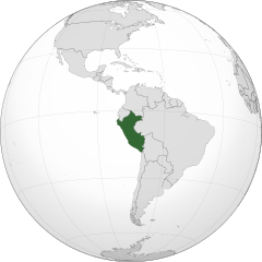
English: A map of the hemisphere centred on -75, -9, using an orthographic projection, created using gringer's Perl script with Natural Earth Data (1:50000 resolution, simplified to 0.25px). Peru is highlighted in green.
Peru |
| Date | |
| Source | Own work with Natural Earth Data |
| Author | Addicted04 |
| SVG development |
Licensing
I, the copyright holder of this work, hereby publish it under the following license:
This file is licensed under the Creative Commons Attribution-Share Alike 3.0 Unported license.
- You are free:
- to share – to copy, distribute and transmit the work
- to remix – to adapt the work
- Under the following conditions:
- attribution – You must give appropriate credit, provide a link to the license, and indicate if changes were made. You may do so in any reasonable manner, but not in any way that suggests the licensor endorses you or your use.
- share alike – If you remix, transform, or build upon the material, you must distribute your contributions under the same or compatible license as the original.
File history
Click on a date/time to view the file as it appeared at that time.
| Date/Time | Thumbnail | Dimensions | User | Comment | |
|---|---|---|---|---|---|
| current | 03:09, 27 July 2018 | | 551 × 551 (1.23 MB) | LeinadCQ | Oculto lagos. |
| 06:56, 6 January 2015 |  | 551 × 551 (1.23 MB) | Denniss | Reverted to version as of 00:37, 20 January 2014 | |
| 03:37, 6 January 2015 |  | 1,800 × 1,400 (534 KB) | Mondolkiri1 | Perú en UNASUR /Peru na UNASUL | |
| 00:37, 20 January 2014 |  | 551 × 551 (1.23 MB) | Addicted04 | New map | |
| 22:26, 10 December 2011 |  | 550 × 550 (918 KB) | Addicted04 |
File usage
The following 3 pages use this file:
Global file usage
The following other wikis use this file:
- Usage on ar.wikipedia.org
- مستخدم:جار الله/قائمة صور مقالات العلاقات الثنائية
- العلاقات الأمريكية البيروية
- العلاقات الأنغولية البيروية
- العلاقات البيروية الكورية الجنوبية
- العلاقات الإريترية البيروية
- العلاقات البيروية السويسرية
- العلاقات الألمانية البيروية
- العلاقات البيروية الليختنشتانية
- العلاقات البوليفية البيروية
- العلاقات البيروية الموزمبيقية
- العلاقات الألبانية البيروية
- العلاقات البلجيكية البيروية
- العلاقات الإثيوبية البيروية
- العلاقات البيروية البيلاروسية
- العلاقات البيروية الطاجيكستانية
- العلاقات البيروية الروسية
- العلاقات البيروية الرومانية
- العلاقات الأرجنتينية البيروية
- العلاقات البيروية الغامبية
- العلاقات البيروية القبرصية
- العلاقات البيروية السيراليونية
- العلاقات البيروية النيبالية
- العلاقات البيروية الليبيرية
- العلاقات التشيكية البيروية
- العلاقات البيروية الميانمارية
- العلاقات البيروية السعودية
- العلاقات البيروية الزيمبابوية
- العلاقات الإسرائيلية البيروية
- العلاقات البالاوية البيروية
- العلاقات البيروية المالية
- العلاقات البيروية النيجيرية
- العلاقات البيروية اليمنية
- العلاقات البيروية الفانواتية
- العلاقات البيروية الغابونية
- العلاقات البنمية البيروية
- العلاقات البيروية الكوبية
- العلاقات البيروية الجورجية
- العلاقات البيروية التونسية
- العلاقات البيروية الكورية الشمالية
- العلاقات البيروية الهندية
- العلاقات البيروية اليابانية
- العلاقات الإيطالية البيروية
- العلاقات البيروية الناوروية
- العلاقات الأسترالية البيروية
- العلاقات البيروية الزامبية
- العلاقات البيروية الفيجية
- العلاقات البيروية المارشالية
- العلاقات الأذربيجانية البيروية
- العلاقات البيروية السودانية
- العلاقات البيروية الكويتية
View more global usage of this file.