
File:Paul Ricard.svg

Size of this PNG preview of this SVG file: 800 × 505 pixels. Other resolutions: 320 × 202 pixels | 640 × 404 pixels | 1,024 × 646 pixels | 1,280 × 808 pixels | 2,560 × 1,616 pixels | 1,445 × 912 pixels.
Original file (SVG file, nominally 1,445 × 912 pixels, file size: 43 KB)
| This is a file from the Wikimedia Commons. Information from its description page there is shown below. Commons is a freely licensed media file repository. You can help. |
Summary
| Description |
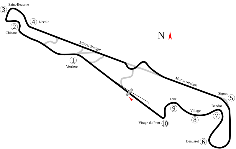
English: Track map for Circuit Paul Ricard 1D Circuit (2002-present) |
| Date | |
| Source | Own work |
| Author | Will Pittenger |
| Other versions |
|

| Camera location | | View this and other nearby images on: OpenStreetMap |
|---|
Licensing
| I, the copyright holder of this work, release this work into the public domain. This applies worldwide. In some countries this may not be legally possible; if so: I grant anyone the right to use this work for any purpose, without any conditions, unless such conditions are required by law. |
File history
Click on a date/time to view the file as it appeared at that time.
| Date/Time | Thumbnail | Dimensions | User | Comment | |
|---|---|---|---|---|---|
| current | 03:57, 24 July 2008 | | 1,445 × 912 (43 KB) | Will Pittenger | {{Information |Description={{en|1=Track map for w:Circuit Paul Ricard.}} |Source=Own work by uploader |Author=Will Pittenger |Date=7-23-2008 |Permission= |other_versions=<gallery>Image:Circuit Paul Ricard.png|Old version &mdas |
File usage
The following page uses this file:
Global file usage
The following other wikis use this file:
- Usage on af.wikipedia.org
- Usage on ar.wikipedia.org
- Usage on ast.wikipedia.org
- Usage on bg.wikipedia.org
- Usage on bn.wikipedia.org
- Usage on br.wikipedia.org
- Usage on ca.wikipedia.org
- Usage on cs.wikipedia.org
- Usage on da.wikipedia.org
- Usage on en.wikipedia.org
- Circuit Paul Ricard
- User talk:Chubbennaitor/archive2
- User talk:Barkjon/Archive 2
- Wikipedia:WikiProject Formula One/Newsletter/200808
- User talk:Hellboy2hell/archive2
- User talk:NapHit/Archive 1
- User talk:4u1e/archive5
- User talk:Typ932/Archive 3
- User talk:Midgrid/Archive 6
- User talk:Thelb4/Archive 5
- User talk:Chubbennaitor/Archive7
- User talk:Readro/Archive 3
- User talk:Donnie Park/Archive 1
- User talk:The359/Archive 4
- User talk:Cs-wolves/Archive 3
- User talk:Bam123456789/Archive 1
- User talk:Sage Callahan/Archive 1
- User talk:Cdhaptomos/Archive 1
- User talk:Spenalzo/Archive/2008
- User talk:Clyde1998/Archive/2008
- User:SSSB/sandbox/testing
- Usage on es.wikipedia.org
- Usage on eu.wikipedia.org
- Usage on fi.wikipedia.org
- Usage on fr.wikipedia.org
- Discussion:Circuit Paul-Ricard
- Liste des circuits du championnat du monde Superbike
- Formule 1
- Wikipédia:Statistiques des anecdotes de la page d'accueil/Visibilité des anecdotes (2018)
- Discussion:Circuit Paul-Ricard/LSV 14879
- Wikipédia:Statistiques des anecdotes de la page d'accueil/Visibilité des anecdotes (2018)/2018 06
- Projet:Aide et accueil/Twitter/Tweets/archives/juin 2018
View more global usage of this file.