
File:Roanoke map 1584.JPG
Size of this preview: 293 × 598 pixels. Other resolutions: 117 × 240 pixels | 235 × 480 pixels | 648 × 1,323 pixels.
Original file (648 × 1,323 pixels, file size: 466 KB, MIME type: image/jpeg)
| This is a file from the Wikimedia Commons. Information from its description page there is shown below. Commons is a freely licensed media file repository. You can help. |
Summary
| Description |
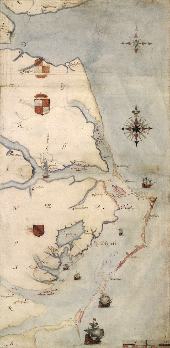
1585 map of the east coast of North America from the Chesapeake Bay to Cape Lookout by John White. Nederlands: Een kaart van het Roanoke-gebied, door John White |
|||||||||||||||||||||||
| Date | between 1585 and 1593 | |||||||||||||||||||||||
| Source | A British Museum photograph of the map. [1] | |||||||||||||||||||||||
| Author |
|
|||||||||||||||||||||||

| This is a retouched picture, which means that it has been digitally altered from its original version. Modifications: cropped and slight levels adjustment. Modifications made by Earthsound.
|
Licensing
|
This is a faithful photographic reproduction of a two-dimensional, public domain work of art. The work of art itself is in the public domain for the following reason:
The official position taken by the Wikimedia Foundation is that "faithful reproductions of two-dimensional public domain works of art are public domain".
This photographic reproduction is therefore also considered to be in the public domain in the United States. In other jurisdictions, re-use of this content may be restricted; see Reuse of PD-Art photographs for details. | ||||
File history
Click on a date/time to view the file as it appeared at that time.
| Date/Time | Thumbnail | Dimensions | User | Comment | |
|---|---|---|---|---|---|
| current | 14:08, 10 July 2013 | | 648 × 1,323 (466 KB) | Earthsound | higher resolution version |
| 01:56, 8 October 2009 |  | 373 × 767 (59 KB) | Multixfer | Higher resolution | |
| 17:43, 7 April 2005 |  | 161 × 326 (16 KB) | Ary29 | 1584 map by John White of Chesapeake Bay to Cape Lookout. {{PD}} Source: en:Image:Ronokmap.JPG Category:Maps of the United States |
File usage
There are no pages that use this file.
Global file usage
The following other wikis use this file:
- Usage on ar.wikipedia.org
- Usage on arz.wikipedia.org
- Usage on az.wikipedia.org
- Usage on be.wikipedia.org
- Usage on bg.wikipedia.org
- Usage on de.wikipedia.org
- Usage on en.wikipedia.org
- Thirteen Colonies
- 1580s
- 1584
- John White (colonist and artist)
- Roanoke Colony
- List of North Carolina hurricanes (pre-1900)
- Portal:Tropical cyclones/Featured article/List of North Carolina hurricanes (pre-1900)
- Core Banks, North Carolina
- Simon Fernandes
- Raid on St. Augustine
- Wikipedia:Top 25 Report/September 11 to 17, 2016
- Wikipedia:Wikipedia Signpost/2016-09-29/Traffic report
- Wikipedia:Top 25 Report/September 18 to 24, 2016
- Wikipedia:Wikipedia Signpost/Single/2016-09-29
- Usage on eo.wikipedia.org
- Usage on es.wikipedia.org
- Usage on fi.wikipedia.org
- Usage on fr.wikipedia.org
- Usage on he.wikipedia.org
- Usage on hu.wikipedia.org
- Usage on hy.wikipedia.org
- Usage on is.wikipedia.org
- Usage on it.wikipedia.org
- Usage on ja.wikipedia.org
- Usage on ko.wikipedia.org
- Usage on mk.wikipedia.org
- Usage on ml.wikipedia.org
- Usage on nl.wikipedia.org
- Usage on no.wikipedia.org
- Usage on nrm.wikipedia.org
- Usage on pl.wikipedia.org
View more global usage of this file.