
File:Struve Geodetic Arc in Felshtyn.jpg

Size of this preview: 800 × 600 pixels. Other resolutions: 320 × 240 pixels | 640 × 480 pixels | 1,024 × 768 pixels | 1,280 × 960 pixels | 2,560 × 1,920 pixels.
Original file (2,560 × 1,920 pixels, file size: 454 KB, MIME type: image/jpeg)
| This is a file from the Wikimedia Commons. Information from its description page there is shown below. Commons is a freely licensed media file repository. You can help. |
Summary
| Description |
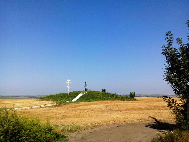
Українська: Геодезичний пункт Дуги Струве у Фельштині (тепер - с. Гвардійське Хмельницького району Хмельницької області). Дуга Струве включена в Список Світової спадщини ЮНЕСКО. English: Сommemorative plaque of Struve Geodetic Arc in Felshtyn, not far from Hvardiyske
|
||
| Date | |||
| Source | Own work | ||
| Author | Volodymyr D-k | ||
| Other versions | Derivative works of this file: Struve Geodetic Arc in Felshtyn banner.jpg |
Licensing
I, the copyright holder of this work, hereby publish it under the following license:
This file is licensed under the Creative Commons Attribution-Share Alike 3.0 Unported license.
- You are free:
- to share – to copy, distribute and transmit the work
- to remix – to adapt the work
- Under the following conditions:
- attribution – You must give appropriate credit, provide a link to the license, and indicate if changes were made. You may do so in any reasonable manner, but not in any way that suggests the licensor endorses you or your use.
- share alike – If you remix, transform, or build upon the material, you must distribute your contributions under the same or compatible license as the original.
File history
Click on a date/time to view the file as it appeared at that time.
| Date/Time | Thumbnail | Dimensions | User | Comment | |
|---|---|---|---|---|---|
| current | 11:26, 7 August 2013 | | 2,560 × 1,920 (454 KB) | Volodymyr D-k | User created page with UploadWizard |
File usage
The following page uses this file:
Global file usage
The following other wikis use this file:
- Usage on ar.wikipedia.org
- Usage on az.wikipedia.org
- Usage on be.wikipedia.org
- Usage on da.wikipedia.org
- Usage on de.wikipedia.org
- Usage on de.wikivoyage.org
- Usage on en.wikipedia.org
- Usage on en.wikivoyage.org
- Usage on es.wikipedia.org
- Usage on fi.wikipedia.org
- Usage on fr.wikipedia.org
- Usage on fy.wikipedia.org
- Usage on hi.wikipedia.org
- Usage on hy.wikipedia.org
- Usage on id.wikipedia.org
- Usage on it.wikivoyage.org
- Usage on ja.wikipedia.org
- Usage on ka.wikipedia.org
- Usage on lv.wikipedia.org
- Usage on ml.wikipedia.org
- Usage on mr.wikipedia.org
- Usage on mt.wikipedia.org
- Usage on nn.wikipedia.org
- Usage on no.wikipedia.org
- Usage on pl.wikipedia.org
- Usage on pt.wikipedia.org
- Usage on ru.wikipedia.org
- Usage on sl.wikipedia.org
- Usage on th.wikipedia.org
- Usage on tr.wikipedia.org
- Usage on uk.wikipedia.org
- Гвардійське (Хмельницький район)
- Список об'єктів Світової спадщини ЮНЕСКО в Україні
- Список об'єктів Світової спадщини ЮНЕСКО в Європі
- Геодезична дуга Струве Хмельниччини
- Вікіпедія:Пам'ятки національного значення із фото і без статей/Хмельницька область
- Вікіпедія:Wiki Loves Monuments/Хмельницька область/Хмельницький район
- Usage on vi.wikipedia.org
- Usage on zh.wikipedia.org