
File:Tammy 1415z 051005.jpg

Size of this preview: 800 × 500 pixels. Other resolutions: 320 × 200 pixels | 640 × 400 pixels | 1,024 × 640 pixels | 1,280 × 800 pixels | 1,920 × 1,200 pixels.
Original file (1,920 × 1,200 pixels, file size: 394 KB, MIME type: image/jpeg)
| This is a file from the Wikimedia Commons. Information from its description page there is shown below. Commons is a freely licensed media file repository. You can help. |
Summary
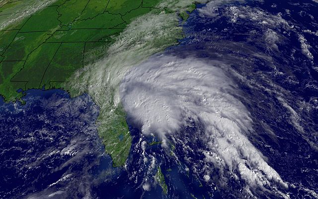
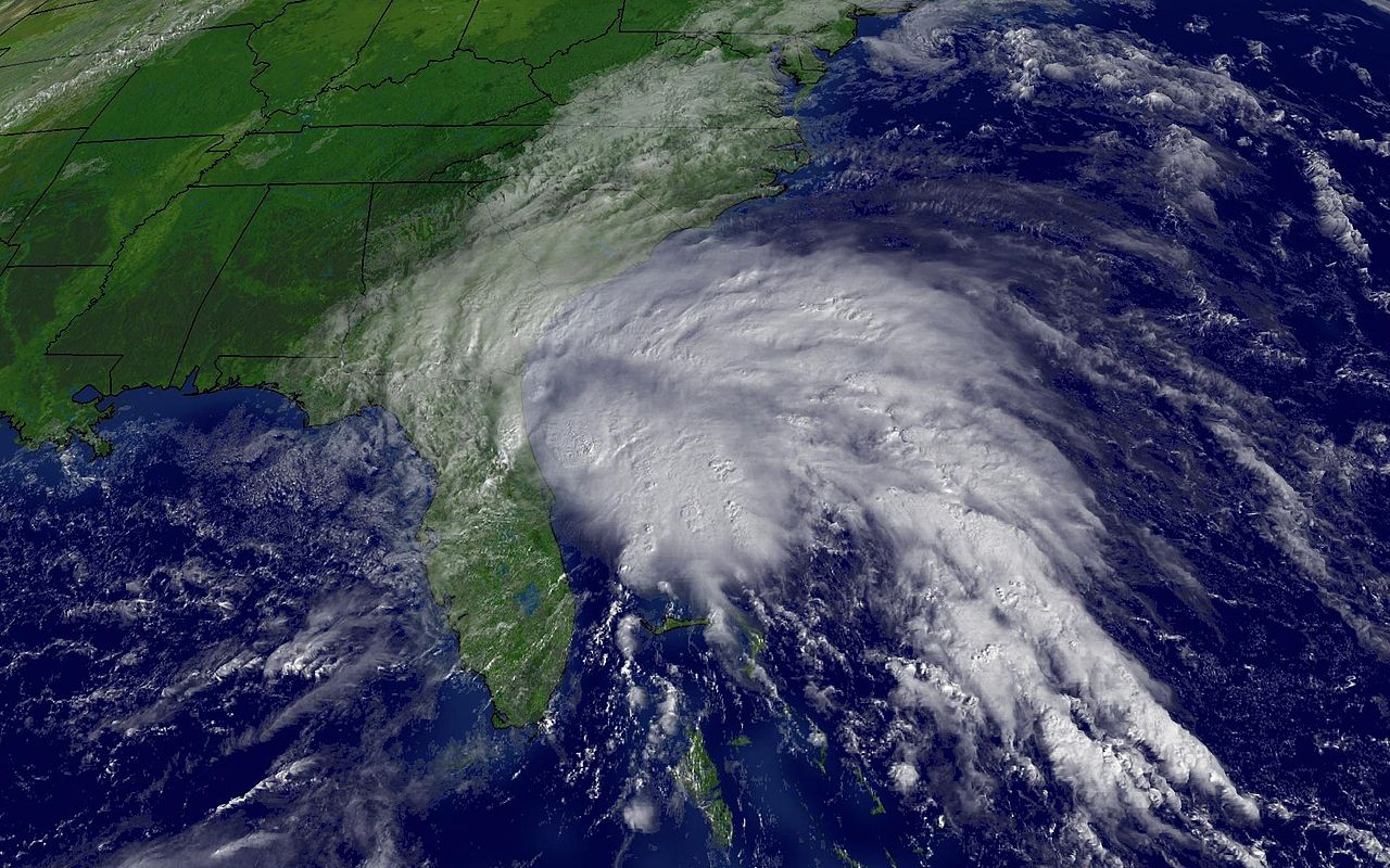
| Description | Tropical Storm Tammy regional imagery, October 5, 2005 at 1415Z. Centerpoint Latitude: 30:11:27N Longitude: 77:29:27W. | |||
| Date | ||||
| Source | http://www.nnvl.noaa.gov/cgi-bin/index.cgi?page=items&ser=109847 | |||
| Author | NOAA GOES-12 1 km visible imagery | |||
| Permission (Reusing this file) |
|
File history
Click on a date/time to view the file as it appeared at that time.
| Date/Time | Thumbnail | Dimensions | User | Comment | |
|---|---|---|---|---|---|
| current | 16:10, 21 December 2005 | | 1,920 × 1,200 (394 KB) | The Shadow Knows | Tropical Storm Tammy (regional imagery) 2005.10.05 at 1415Z. '''Centerpoint :''' *'''Latitude:''' 30:11:27N *'''Longitude:''' 77:29:27W. '''Observation Device:''' GOES-12 1 km visible imagery. From URL http://www.nnvl.noaa.gov/cgi-bin/index.cgi?page=it |
File usage
The following 2 pages use this file:
Global file usage
The following other wikis use this file:
- Usage on eu.wikipedia.org
- Usage on fr.wikipedia.org
- Usage on pt.wikipedia.org