
File:Tropical Storm Dolly (2002).jpg

Size of this preview: 600 × 600 pixels. Other resolutions: 240 × 240 pixels | 480 × 480 pixels | 768 × 768 pixels | 1,024 × 1,024 pixels | 2,048 × 2,048 pixels | 6,000 × 6,000 pixels.
Original file (6,000 × 6,000 pixels, file size: 3.48 MB, MIME type: image/jpeg)
| This is a file from the Wikimedia Commons. Information from its description page there is shown below. Commons is a freely licensed media file repository. You can help. |
Summary
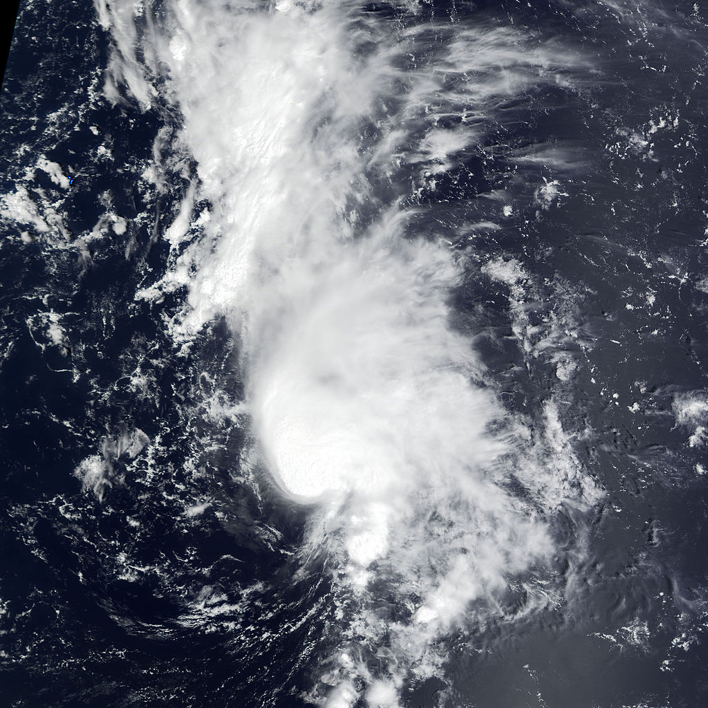
| Description | Tropical Storm Dolly can be seen heading northeast in the central Atlantic in this true-color image taken on September 2, 2002, by the Moderate Resolution Imaging Spectroradiometer (MODIS), flying aboard NASA's Terra spacecraft. When this image was taken, the storm was near its peak with gusts of up to 63 miles (100 kilometers) per hour. As of September 4, the storm has diminished to a tropical depression, packing winds of only 30 miles (45 kilometers) per hour. | |||||
| Date | ||||||
| Source | http://earthobservatory.nasa.gov/NaturalHazards/natural_hazards_v2.php3?img_id=4744 | |||||
| Author | Image by Jesse Allen, based on data from the MODIS Rapid Response Team at NASA-GSFC | |||||
| Permission (Reusing this file) |
|

.jpg)
File history
Click on a date/time to view the file as it appeared at that time.
| Date/Time | Thumbnail | Dimensions | User | Comment | |
|---|---|---|---|---|---|
| current | 10:13, 28 September 2015 | | 6,000 × 6,000 (3.48 MB) | Nino Marakot | better version, reduced file milibar |
| 02:59, 26 January 2010 |  | 6,000 × 6,000 (4.24 MB) | Supportstorm | Reverted to version as of 21:47, 22 August 2006 | |
| 02:57, 26 January 2010 |  | 540 × 540 (68 KB) | Supportstorm | Reverted to version as of 00:45, 23 December 2005 | |
| 18:55, 2 January 2010 |  | 6,000 × 6,000 (4.24 MB) | Supportstorm | Reverted to version as of 21:47, 22 August 2006 | |
| 03:47, 28 December 2009 |  | 6,000 × 6,000 (3.64 MB) | Supportstorm | Image Touch up | |
| 21:47, 22 August 2006 |  | 6,000 × 6,000 (4.24 MB) | Good kitty | ||
| 00:45, 23 December 2005 |  | 540 × 540 (68 KB) | Hurricanehink | From http://visibleearth.nasa.gov/view_set.php?sensorName=all&p=253, this satellite image shows Tropical Storm Dolly to the northeast of the Lesser Antilles in early September. {{PD-USGov-NOAA}} {{NOAA logo}} |
File usage
The following page uses this file:
Global file usage
The following other wikis use this file:
- Usage on fr.wikipedia.org
.jpg)