
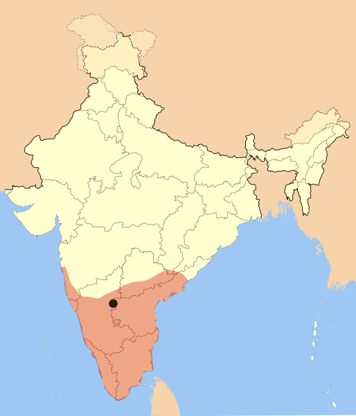
File:Vijayanagara-empire-map.svg

Size of this PNG preview of this SVG file: 514 × 600 pixels. Other resolutions: 206 × 240 pixels | 411 × 480 pixels | 658 × 768 pixels | 877 × 1,024 pixels | 1,755 × 2,048 pixels | 1,585 × 1,850 pixels.
Original file (SVG file, nominally 1,585 × 1,850 pixels, file size: 372 KB)
| This is a file from the Wikimedia Commons. Information from its description page there is shown below. Commons is a freely licensed media file repository. You can help. |
rambabu
Summary
I used Image:India-locator-map-blank.svg as base and edited myself using Inkscape and created it by looking at the following sources.
- Dr. Suryanath U. Kamath, A Concise history of Karnataka from pre-historic times to the present, Jupiter books, MCC, 2001 (Reprinted 2002) (page no - 329)
- Durga Prasad, History Andhras upto 1565 A. D., 1988, P.G. Publishers, Don Bosco School Press, Guntur, p268-270(page no - 234)
- and http://www.britannica.com/eb/art-1959
Empire was under its peak when Goa was captured and won many portions of Andhra Pradesh from Gajapati's of Orissa.
Color and opacity are changed on May 27, 2007.
| Description | Vijaya Nagara Empire Map |
| Date | |
| Source | Own work |
| Author | Mlpkr |
| SVG development |
Licensing
I, the copyright holder of this work, hereby publish it under the following licenses:

|
Permission is granted to copy, distribute and/or modify this document under the terms of the GNU Free Documentation License, Version 1.2 or any later version published by the Free Software Foundation; with no Invariant Sections, no Front-Cover Texts, and no Back-Cover Texts. A copy of the license is included in the section entitled GNU Free Documentation License. |
| This file is licensed under the Creative Commons Attribution-Share Alike 3.0 Unported license. | ||
| ||
| This licensing tag was added to this file as part of the GFDL licensing update. |
This file is licensed under the Creative Commons Attribution-Share Alike 2.5 Generic, 2.0 Generic and 1.0 Generic license.
- You are free:
- to share – to copy, distribute and transmit the work
- to remix – to adapt the work
- Under the following conditions:
- attribution – You must give appropriate credit, provide a link to the license, and indicate if changes were made. You may do so in any reasonable manner, but not in any way that suggests the licensor endorses you or your use.
- share alike – If you remix, transform, or build upon the material, you must distribute your contributions under the same or compatible license as the original.
You may select the license of your choice.
File history
Click on a date/time to view the file as it appeared at that time.
| Date/Time | Thumbnail | Dimensions | User | Comment | |
|---|---|---|---|---|---|
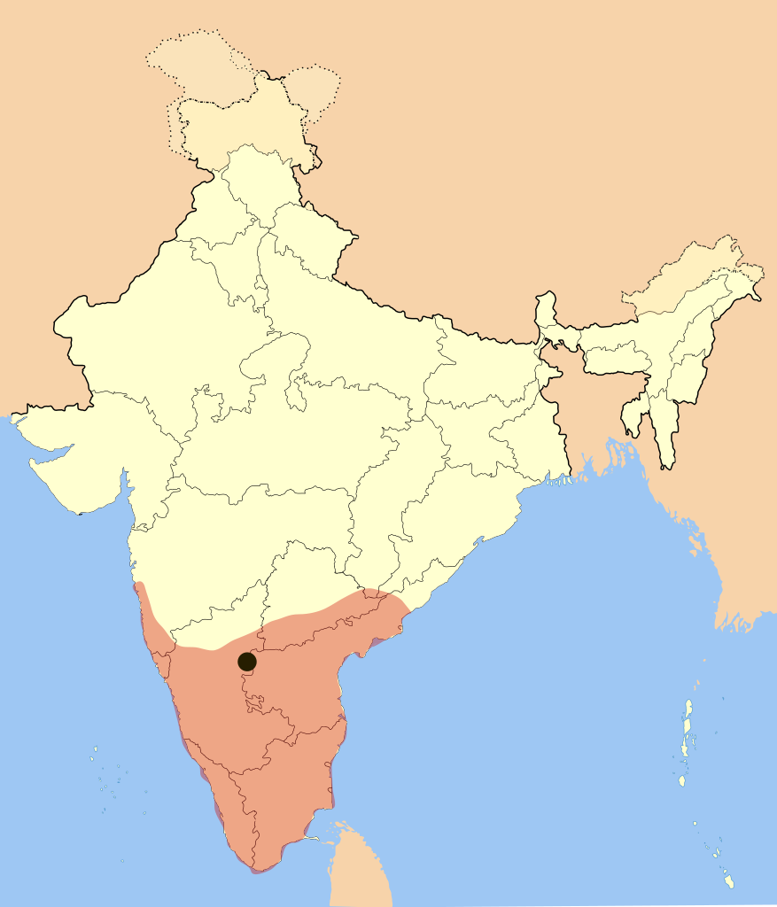
| current | 20:09, 3 March 2017 | | 1,585 × 1,850 (372 KB) | BurritoBazooka | rederive from new modern boundaries map. Some state borders have changed (Telangana). |
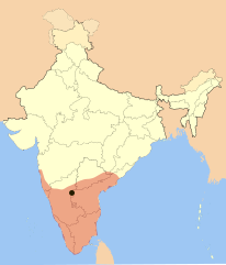
| 00:05, 28 May 2007 |  | 1,651 × 1,753 (432 KB) | Mlpkr | I used Image:India-locator-map-blank.svg as base and edited myself using inkspace and created it by looking at the following sources. * Dr. Suryanath U. Kamath, A Concise history of Karnataka from pre-historic times to the present, Jupiter books, MC | |
| 16:49, 24 January 2007 |  | 1,651 × 1,753 (432 KB) | Mlpkr | All of the old copyrights with only difference, adding a dot for the capitol. | |
| 20:34, 17 January 2007 |  | 1,651 × 1,753 (428 KB) | Mlpkr | == Summary == I used Image:India-locator-map-blank.svg as base and edited myself using inkspace and created it by looking at the following sources. * Dr. Suryanath U. Kamath, A Concise history of Karnataka from pre-historic times to the present, Jup |
File usage
The following page uses this file:
Global file usage
The following other wikis use this file:
- Usage on ast.wikipedia.org
- Usage on azb.wikipedia.org
- Usage on ba.wikipedia.org
- Usage on be.wikipedia.org
- Usage on bg.wikipedia.org
- Usage on bn.wikipedia.org
- Usage on br.wikipedia.org
- Usage on ca.wikipedia.org
- Usage on cs.wikipedia.org
- Usage on da.wikipedia.org
- Usage on de.wikipedia.org
- Usage on en.wikipedia.org
- Usage on en.wikivoyage.org
- Usage on eo.wikipedia.org
- Usage on eu.wikipedia.org
- Usage on fa.wikipedia.org
- Usage on fi.wikipedia.org
- Usage on gl.wikipedia.org
- Usage on gu.wikipedia.org
- Usage on he.wikipedia.org
- Usage on hi.wikipedia.org
- Usage on hr.wikipedia.org
- Usage on hu.wikipedia.org
- Usage on hy.wikipedia.org
- Usage on id.wikipedia.org
- Usage on it.wikipedia.org
- Usage on ja.wikipedia.org
- Usage on ka.wikipedia.org
- Usage on kn.wikipedia.org
- Usage on lt.wikipedia.org
- Usage on ml.wikipedia.org
- Usage on mr.wikipedia.org
- Usage on ms.wikipedia.org
- Usage on ne.wikipedia.org
View more global usage of this file.