
File:Vinson-Map.jpg

Size of this preview: 626 × 599 pixels. Other resolutions: 251 × 240 pixels | 501 × 480 pixels | 802 × 768 pixels | 1,070 × 1,024 pixels | 2,139 × 2,048 pixels | 3,207 × 3,070 pixels.
Original file (3,207 × 3,070 pixels, file size: 5.48 MB, MIME type: image/jpeg)
| This is a file from the Wikimedia Commons. Information from its description page there is shown below. Commons is a freely licensed media file repository. You can help. |
| Description |
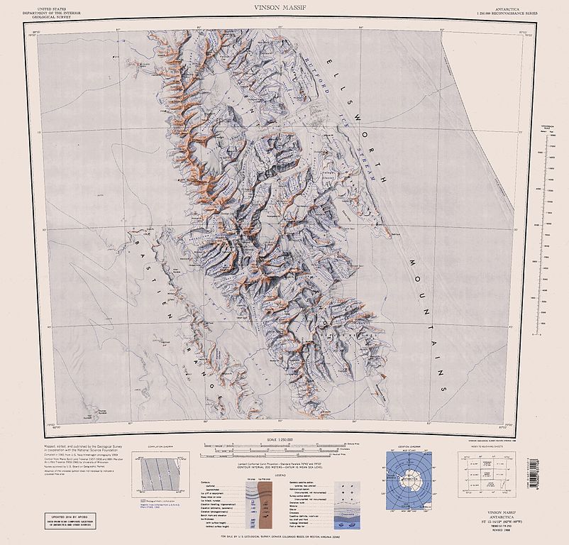
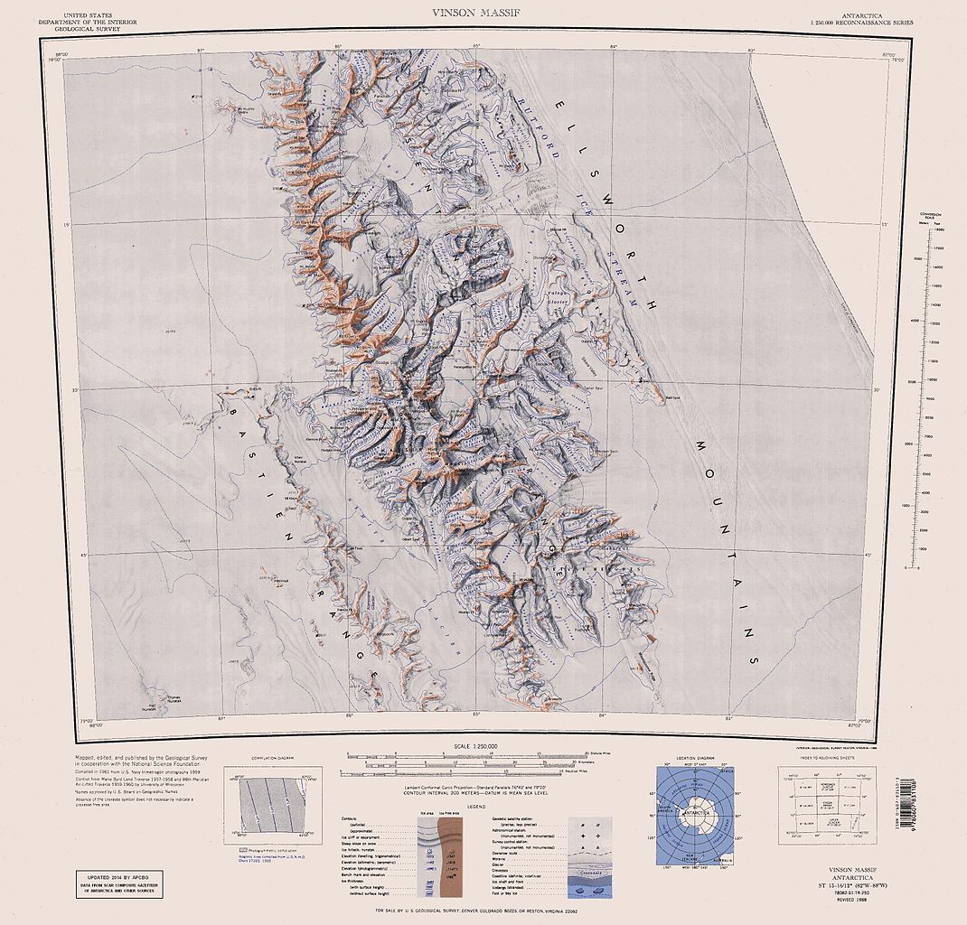
English: Map of Antarctica by the United States Antarctic Resource Center of the US Geological Survey (USGS). |
| Date | |
| Source | https://usarc.usgs.gov/drgs/dir1/c78082s1.jpg |
| Author | United States Department of the Interior: Geological Survey |
| Other versions |
Trimmed and updated version of Wikimedia Commons Image:C78082s1_Ant.Map_Vinson_Massif.jpg. |
This image is in the public domain in the United States because it only contains materials that originally came from the United States Geological Survey, an agency of the United States Department of the Interior. For more information, see the official USGS copyright policy.
|
File history
Click on a date/time to view the file as it appeared at that time.
| Date/Time | Thumbnail | Dimensions | User | Comment | |
|---|---|---|---|---|---|
| current | 16:25, 22 January 2014 | | 3,207 × 3,070 (5.48 MB) | Apcbg | Updated with data from SCAR Composite Gazetteer of Antarctica and other sources. |
| 07:11, 27 August 2013 |  | 3,207 × 3,070 (5.47 MB) | Apcbg | Updated with data from SCAR Composite Gazetteer of Antarctica and other sources. | |
| 16:34, 9 July 2011 |  | 3,207 × 3,070 (5.46 MB) | Apcbg | Updated with data from SCAR Composite Gazetteer of Antarctica and other sources. | |
| 17:34, 8 March 2011 |  | 3,207 × 3,070 (5.47 MB) | Apcbg | Updated with data from SCAR Composite Gazetteer of Antarctica and other sources. | |
| 16:52, 13 October 2010 |  | 3,207 × 3,070 (5.45 MB) | Apcbg | Updated with data from SCAR Composite Gazetteer of Antarctica and other sources. | |
| 10:27, 30 January 2007 |  | 3,207 × 3,070 (5.4 MB) | Apcbg | Map of Antarctica by the United States Antarctic Ressource Center of the US Geological Society. Trimmed version of Wikimedia image C78082s1_Ant.Map_Vinson_Massif.jpg {{PD-US}} Copyrights and Trademarks USGS-authored or produced data and information are |
File usage
The following page uses this file:
Global file usage
The following other wikis use this file:
- Usage on ar.wikipedia.org
- Usage on ast.wikipedia.org
- Usage on az.wikipedia.org
- Mirovyane zirvəsi
- Zimornitsa zirvəsi
- Fuça zirvəsi
- Bezden zirvəsi
- Oreşak zirvəsi
- Qolemani zirvəsi
- Marsa buzlağı
- Patleyna buzlağı
- Embree buzlağı
- Kopsis buzlağı
- Padala buzlağı
- Ellen buzlağı
- Fonfon buzlağı
- Gerila buzlağı
- Rumyana buzlağı
- Delyo buzlağı
- Burdenis buzlağı
- Arapya buzlağı
- Pulpudeva buzlağı
- Mamarçev zirvəsi
- Rutford
- Usage on bg.wikipedia.org
- Usage on ca.wikipedia.org
- Usage on ceb.wikipedia.org
View more global usage of this file.