
File:Woomera Test Range map.svg

Size of this PNG preview of this SVG file: 516 × 599 pixels. Other resolutions: 207 × 240 pixels | 413 × 480 pixels | 661 × 768 pixels | 882 × 1,024 pixels | 1,763 × 2,048 pixels | 1,535 × 1,783 pixels.
Original file (SVG file, nominally 1,535 × 1,783 pixels, file size: 318 KB)
| This is a file from the Wikimedia Commons. Information from its description page there is shown below. Commons is a freely licensed media file repository. You can help. |
| Description |
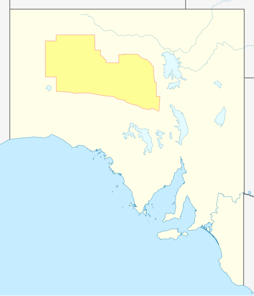
English: Approximate geographic map of Woomera Test Range in South Australia |
| Date | (UTC) |
| Source | |
| Author |
|
| This is a retouched picture, which means that it has been digitally altered from its original version. Modifications: Added test range. The original can be viewed here: Australia South Australia location map blank.svg:
|
I, the copyright holder of this work, hereby publish it under the following license:
This file is licensed under the Creative Commons Attribution-Share Alike 3.0 Unported license.
- You are free:
- to share – to copy, distribute and transmit the work
- to remix – to adapt the work
- Under the following conditions:
- attribution – You must give appropriate credit, provide a link to the license, and indicate if changes were made. You may do so in any reasonable manner, but not in any way that suggests the licensor endorses you or your use.
- share alike – If you remix, transform, or build upon the material, you must distribute your contributions under the same or compatible license as the original.
Original upload log
This image is a derivative work of the following images:
- File:Australia_South_Australia_location_map_blank.svg licensed with Cc-by-sa-3.0
- 2010-04-10T00:34:15Z Roke 1535x1783 (323903 Bytes) {{Information |Description={{de|Positionskarte von [[:de:South Australia|South Australia]], [[:de:Australien|Australien]]}} Quadratische Plattkarte, N-S-Streckung 117 %. Geographische Begrenzung der Karte: * N: 25.6° S * S:
Uploaded with derivativeFX
File history
Click on a date/time to view the file as it appeared at that time.
| Date/Time | Thumbnail | Dimensions | User | Comment | |
|---|---|---|---|---|---|
| current | 02:36, 13 July 2011 | | 1,535 × 1,783 (318 KB) | Pi.1415926535 | {{Information |Description={{en|Approximate geographic map of Woomera Test Range in South Australia}} |Source=*File:Australia_South_Australia_location_map_blank.svg |Date=2011-07-13 02:28 (UTC) |Author=*[[:File:Australia_South_Australia_location_map |
File usage
The following page uses this file:
Global file usage
The following other wikis use this file:
- Usage on en.wikipedia.org
- Usage on es.wikipedia.org
- Usage on he.wikipedia.org
- Usage on ja.wikipedia.org
- Usage on nl.wikipedia.org
- Usage on pl.wikipedia.org
- Usage on pt.wikipedia.org
- Usage on sl.wikipedia.org
- Usage on zh.wikipedia.org