
File:Wpdms nysgis thenarrows.jpg
No higher resolution available.
Wpdms_nysgis_thenarrows.jpg (314 × 413 pixels, file size: 32 KB, MIME type: image/jpeg)
| This is a file from the Wikimedia Commons. Information from its description page there is shown below. Commons is a freely licensed media file repository. You can help. |
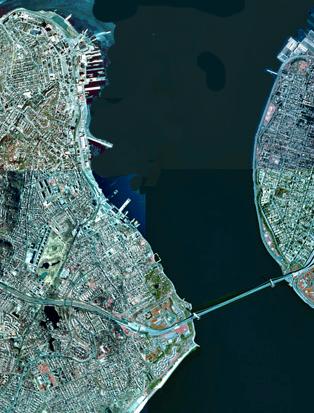
| Description | The Narrows shown in an NYSGIS satellite photo. | ||||||
| Source | http://en.wikipedia.org/wiki/File:Wpdms_nysgis_thenarrows.jpg | ||||||
| Author | NYSGIS | ||||||
| Permission (Reusing this file) |
|
||||||

File history
Click on a date/time to view the file as it appeared at that time.
| Date/Time | Thumbnail | Dimensions | User | Comment | |
|---|---|---|---|---|---|
| current | 14:12, 24 January 2009 | | 314 × 413 (32 KB) | ChickenFalls | {{Information |Description=The Narrows shown in an NYSGIS satellite photo. |Source=http://en.wikipedia.org/wiki/File:Wpdms_nysgis_thenarrows.jpg |Date= |Author=NYSGIS |Permission={{PD-USGov}} |other_versions= }} Category:New York <!--{{ImageUpload|bas |
File usage
The following page uses this file:
Global file usage
The following other wikis use this file:
- Usage on ar.wikipedia.org
- Usage on de.wikipedia.org
- Usage on en.wikipedia.org
- Usage on no.wikipedia.org
- Usage on pt.wikipedia.org