
Gotska Sandön
| Gotska Sandön National Park | |
|---|---|
IUCN category II (national park) | |
 The eastern coast, as seen from the lighthouse. | |
| Location | Gotland County, Sweden |
| Nearest city | Fårösund, Gotland Municipality |
| Coordinates | 58°22′N 19°15′E / 58.367°N 19.250°E |
| Area | 44.9 km2 (17.3 sq mi), of which 8.42 km2 (3.25 sq mi) are water.[1] |
| Established | 1909, extended in 1963 and 1988[1] |
| Governing body | Naturvårdsverket |

Gotska Sandön
Location of Gotska Sandön in Sweden
Gotska Sandön is a Swedish island in the Baltic Sea. It is located cirka 38 kilometres north of Fårö. The island is approximately 9 kilometres long and 6 kilometres wide. Its area is approximately 36 km².
The island mostly Gotska consists of sand. Its nature is dominated by beaches, dunes, and pine forests. In 1909, the island became one of the National parks of Sweden. In the summertime,regular boat tours are moving between the island and Fårö as well as nd Nynäshamn.
Gallery[change | change source]
-
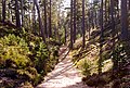 The Schipka Pass is a handmade pass through the sand dunes
 -
 The eastern coast seen from the lighthouse
 -
 The north-eastern coast early in the morning


References[change | change source]
- ↑ 1.0 1.1 "Gotska Sandön National Park". Naturvårdsverket. Archived from the original on 6 September 2015. Retrieved 26 February 2009.
Other websites[change | change source]
![]() Media related to Gotska Sandön at Wikimedia Commons
Media related to Gotska Sandön at Wikimedia Commons
Wikivoyage has a travel guide about: Gotska Sandön
- Gotska Sandön National Park Archived 2011-03-25 at the Wayback Machine from the Swedish Environmental Protection Agency
- Gotska Sandön (in Swedish)
- Birds on Gotska Sandön Archived 2008-01-11 at the Wayback Machine