Hunter Valley
| Hunter Region New South Wales | |||||||||||||||
|---|---|---|---|---|---|---|---|---|---|---|---|---|---|---|---|
 View across the Hunter Valley | |||||||||||||||
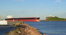
 The mouth of the Hunter River at Newcastle | |||||||||||||||
The location of Newcastle, the major city in the Hunter Region | |||||||||||||||
| Coordinates | 32°55′S 151°45′E / 32.917°S 151.750°E | ||||||||||||||
| Population | 620,530 (2011 census)[Note 1] | ||||||||||||||
| • Density | 21.2911/km2 (55.144/sq mi) | ||||||||||||||
| Area | 29,145 km2 (11,252.9 sq mi) | ||||||||||||||
| Time zone | AEST (UTC+10) | ||||||||||||||
| • Summer (DST) | AEDT (UTC+11) | ||||||||||||||
| Location | 120 km (75 mi) N of Sydney | ||||||||||||||
| LGA(s) |
| ||||||||||||||
| State electorate(s) | |||||||||||||||
| Federal division(s) | |||||||||||||||
| |||||||||||||||
The Hunter Valley is an area of New South Wales, Australia. The Hunter River flows through the valley.[1] The Hunter Valley is one of the largest river valleys on the NSW coast. It is known for its wineries and coal mines. It is about 120 km (75 mi) to 310 km (193 mi) and less than 2 hours drive from north of Sydney, Australia.[2] About 590,000 people live in the valley. More than half of the people live in the coastal cities of Newcastle and Lake Macquarie. There are also other towns and villages across the valley. There are 11 Local Government Areas that look after the area. These eleven LGAs are:[3]
- Cessnock City Council
- Dungog Shire Council
- Gloucester Shire Council
- Great Lakes Council
- Lake Macquarie City Council
- Maitland City Council
- Muswellbrook Shire Council
- Newcastle City Council
- Port Stephens Council
- Singleton Shire Council
- Upper Hunter Shire Council
References[change | change source]
- ↑ "Department of Local Government - Regions". NSW Department of Local Government. Retrieved 5 August 2007.
- ↑ "About Hunter Valley, Newcastle, Port Stephens". Business Events Sydney. Archived from the original on 5 August 2016. Retrieved 30 August 2016.
- ↑ "Local Council Boundaries Hunter (HT)". New South Wales Department of Local Government. Retrieved 16 August 2007.
Notes
- ↑ Population figure is the combined population of all LGAs in the region

