Huron River (Michigan)
| Huron River | |
|---|---|
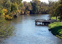
 Huron River in Ypsilanti | |
 A map of the Huron River and its watershed. | |
| Location | |
| Country | United States |
| Physical characteristics | |
| Source | |
| - location | Huron Swamp south of Andersonville, Michigan |
| - elevation | 1,001 ft (305 m) |
| Mouth | |
| - location | Lake Erie southeast of Rockwood, Michigan |
| - elevation | 571 ft (174 m) |
| Length | 130 mi (210 km) |
| Basin size | 908 sq mi (2,350 km2) |
The Huron River is in southeastern Michigan, starting in the Huron Swamp in Indian Springs Metropark in northern Oakland County and ending in Lake Erie.
