Lesse
| Lesse | |
|---|---|
 The Lesse in Han-sur-Lesse. | |
| Location | |
| Country | Belgium |
| Physical characteristics | |
| Source | |
| - location | Ardennes |
| - elevation | 480 m (1,570 ft) |
| Mouth | |
| - location | Meuse |
| Length | 89 km (55 mi) |
| Basin features | |
| Progression | Meuse→ North Sea |
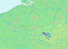
The Lesse (Walloon: Aiwe di Lesse) is a river in the Ardennes, in the Walloon region of Belgium. It is a right tributary to the river Meuse.
Geography[change | change source]


The Lesse is 89 km (55 mi) long. It flows roughly in a northwestern direction. Its source is near Libramont-Chevigny, in the Belgian province of Luxembourg. The mean discharge for Anseremme between 1995 and 2004 was 19.0 m3.[1]
The watershed of the Lesse Basin, with an area of 1,343.4 km2 (518.7 sq mi), has about 1,920 km (1,193 mi). With only 62,500 people living there, it is the least densely populated of all small watersheds of Walloon region.
Part of the watershed of the Lesse is on limestone where there are some karstic phenomena. Near Han-sur-Lesse (commune of Rochefort), by the Gouffre de Belvaux, the entire river goes underground, flowing through limestone caves.
The Lesse flows into the river Meuse in the town of Anseremme, commune of Dinant, Namur province.
Tributaries[change | change source]
From its source to its mouth, the main tributaries of the Lesse are:
- Our, left tributary; it joins the Lesse near Redu.
- Almache, left tributary; it joins the Lesse in Daverdisse.
- Lomme, right tributary; it joins the Lesse in Éprave.
- Wimbe, left tributary; it joins the Lesse in Villers-sur-Lesse.
- Vachaux, right tributary; it joins the Lesse in Ciergnon.
- Biran, left tributary; it joins the Lesse in Wanlin.
- Hileau, left tributary; it joins the Lesse in Houyet.
- Iwoigne, left tributary; it joins the Lesse near Houyet.
Attractions[change | change source]
The valley of the Lesse and this part of the Ardennes are covered with forests. The area surrounding the caves is the National Park Lesse et Lomme. On the mountains along the lower part of the river there are several castles. The route of the former railway line from Houyet to Rochefort is used as a hiking and cycling trail.
Many of the caves along the banks of the Lesse are important archaeological sites - these include the Trou de Chaleux (by the Cirque de Chaleux), and the Trou des Nutons and Trou du Frontal at Furfooz.
It is possible to go down the Lesse in kayak or canoe from Houyet to Anseremme.
References[change | change source]
- ↑ Région Wallonne de Belgique: État des lieux du sous-bassin hydrographique de la Lesse (PDF; 5,9 MB), 2005, S. 8
Other websites[change | change source]
- Val de Lesse Archived 2013-08-23 at the Wayback Machine
- Contrat de rivière de la Lesse (in French)
