Mallacoota, Victoria
| Mallacoota Victoria | |||||||||
|---|---|---|---|---|---|---|---|---|---|
 Mallacoota | |||||||||
| Coordinates | 37°33′0″S 149°45′0″E / 37.55000°S 149.75000°E | ||||||||
| Population | 972 (2006 census)[1] | ||||||||
| Postcode(s) | 3892 | ||||||||
| Elevation | 22 m (72 ft) | ||||||||
| Location | |||||||||
| LGA(s) | Shire of East Gippsland | ||||||||
| State electorate(s) | Gippsland East | ||||||||
| Federal division(s) | Gippsland | ||||||||
| |||||||||

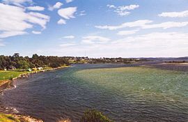
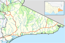
Mallacoota (37°33′S 149°45′E / 37.550°S 149.750°E) is a small town in East Gippsland, Victoria, Australia. Less than 1000 people live there. It is 25 kilometres off the Princes Highway and 523 kilometres (325 mi) kilometres from Melbourne. It is the last town on Victoria's east coast before the border with New South Wales. Mallacoota has a small airport (Mallacoota Airport) YMCO (XMC) for private small planes.
History[change | change source]
The Bidawal Aborigines lived there before Europeans came. Europeans came after about 1830. Gold was found in 1894, and was mined for three years. In the 20th century the logging, farming and fishing industries declined, and the tourism and abalone industries grew. The town's largest business, the abalone co-operative, was started in 1967.
References[change | change source]
- ↑ Australian Bureau of Statistics (25 October 2007). "Mallacoota (State Suburb)". 2006 Census QuickStats. Retrieved 2007-10-01.
Other websites[change | change source]
- Mallacoota District Health and Support Service
- Local community radio station, 3MGB Archived 2005-09-07 at the Wayback Machine
- Mallacoota Arts Council Archived 2008-05-11 at the Wayback Machine

