Morwell, Victoria
| Morwell Victoria | |||||||||||||||
|---|---|---|---|---|---|---|---|---|---|---|---|---|---|---|---|
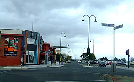
 Corner of Hazelwood and Commercial Roads, Morwell | |||||||||||||||
 | |||||||||||||||
| Coordinates | 38°14′S 146°24′E / 38.233°S 146.400°E | ||||||||||||||
| Population | 13,771 (2016 census)[1] | ||||||||||||||
| Established | 1870s | ||||||||||||||
| Postcode(s) | 3840 | ||||||||||||||
| Elevation | 80 m (262 ft) | ||||||||||||||
| Location | 149 km (93 mi) from Melbourne 59km (36mi) from Leongatha | ||||||||||||||
| LGA(s) | City of Latrobe | ||||||||||||||
| State electorate(s) | Morwell | ||||||||||||||
| Federal division(s) | Gippsland | ||||||||||||||
| |||||||||||||||
Morwell is a city in Gippsland, east of Victoria, Australia. Morwell is in the Latrobe Valley. The Latrobe Valley has a lot of brown coal which is burned to make electricity in power stations. It is also the centre for the City of Latrobe. The name Morwell is believed to have come from the Australian aboriginal Gunnai language meaning "people who live in the swamp".[2]
References[change | change source]
- ↑ Australian Bureau of Statistics (27 June 2017). "Morwell (State Suburn)". 2016 Census QuickStats. Retrieved 2017-11-04.
- ↑ Local Government History Archived 2008-06-22 at the Wayback Machine Morwell Historical Society.

