
Natrona County, Wyoming
Natrona County | |
|---|---|
 Natrona County Courthouse in Casper | |
 Flag | |
 Location within the U.S. state of Wyoming | |
 Wyoming's location within the U.S. | |
| Coordinates: 42°58′N 106°48′W / 42.97°N 106.8°W | |
| Country | |
| State | |
| Named for | Natron deposits |
| Seat | Casper |
| Largest city | Casper |
| Area | |
| • Total | 5,376 sq mi (13,920 km2) |
| • Land | 5,340 sq mi (13,800 km2) |
| • Water | 35 sq mi (90 km2) 0.7% |
| Population (2020) | |
| • Total | 79,955 |
| • Density | 15/sq mi (5.7/km2) |
| Time zone | UTC−7 (Mountain) |
| • Summer (DST) | UTC−6 (MDT) |
| Congressional district | At-large |
| Website | www |
Natrona County is a county in the U.S. state of Wyoming. It was created on December 16, 1868. As of 2020, 79,955 people lived there.[1] Natrona County's seat is Casper.[2]
Communities[change | change source]
Cities[change | change source]
- Casper (county seat)
Towns[change | change source]
Census-designated places[change | change source]
Unincorporated communities[change | change source]
References[change | change source]
- ↑ "QuickFacts: Natrona County, Wyoming". United States Census Bureau. Retrieved January 21, 2024.
- ↑ National Association of Counties. "NACo County Explorer". Retrieved January 21, 2024.
Other websites[change | change source]
Places next to Natrona County, Wyoming | ||||||||||
|---|---|---|---|---|---|---|---|---|---|---|
| ||||||||||
Municipalities and communities of Natrona County, Wyoming, United States | ||
|---|---|---|
| City | 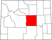 | |
| Towns | ||
| CDPs | ||
| Unincorporated communities | ||