
Oberlin, Louisiana
Oberlin, Louisiana | |
|---|---|
| Town of Oberlin | |
 Downtown Oberlin with the Allen Parish Courthouse in the background | |
 Interactive map of Oberlin | |
| Coordinates: 30°37′10″N 92°45′51″W / 30.61944°N 92.76417°W | |
| Country | |
| State | |
| Parish | Allen |
| Government | |
| • Mayor | Larry Alexander |
| Area | |
| • Total | 4.38 sq mi (11.35 km2) |
| • Land | 4.38 sq mi (11.35 km2) |
| • Water | 0.00 sq mi (0.01 km2) |
| Elevation | 69 ft (21 m) |
| Population | |
| • Total | 1,402 |
| • Density | 320.02/sq mi (123.55/km2) |
| Time zone | UTC-6 (CST) |
| • Summer (DST) | UTC-5 (CDT) |
| ZIP Code | 70655 |
| Area code | 337 |
| FIPS code | 22-57450 |
Oberlin is the parish seat of Allen Parish, Louisiana, United States. As of the 2020 census count, 1,402 people lived in the city.[2]
References[change | change source]
- ↑ "2020 U.S. Gazetteer Files". United States Census Bureau. Retrieved March 20, 2022.
- ↑ 2.0 2.1 "Profile of General Population and Housing Characteristics: 2020 Demographic Profile Data (DP-1): Oberlin town, Louisiana". United States Census Bureau. Retrieved March 3, 2024.
Municipalities and communities of Allen Parish, Louisiana, United States | ||
|---|---|---|
| City | 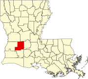 | |
| Towns | ||
| Villages | ||
| Unincorporated communities | ||
| Indian reservation | ||
| Footnotes | ‡This populated place also has portions in an adjacent county or counties | |