
Sheboygan County, Wisconsin
Sheboygan County | |
|---|---|
 Sheboygan County Courthouse | |
 Location within the U.S. state of Wisconsin | |
 Wisconsin's location within the U.S. | |
| Coordinates: 43°43′N 87°40′W / 43.72°N 87.66°W | |
| Country | |
| State | |
| Founded | 1846 |
| Seat | Sheboygan |
| Largest city | Sheboygan |
| Area | |
| • Total | 1,271 sq mi (3,290 km2) |
| • Land | 511 sq mi (1,320 km2) |
| • Water | 760 sq mi (2,000 km2) 59.8% |
| Population | |
| • Total | 118,034 |
| • Density | 230.7/sq mi (89.1/km2) |
| Time zone | UTC−6 (Central) |
| • Summer (DST) | UTC−5 (CDT) |
| Congressional district | 6th |
| Website | sheboygancounty |
Sheboygan County is a county in the U.S. state of Wisconsin. As of the 2020 census, 118,034 people lived there.[1] Its county seat is Sheboygan.[2] The whole county forms the Sheboygan, Wisconsin, Metropolitan Statistical Area.
Geography[change | change source]
| Historical population | |||
|---|---|---|---|
| Census | Pop. | %± | |
| 1840 | 133 | — | |
| 1850 | 8,379 | 6,200.0% | |
| 1860 | 26,875 | 220.7% | |
| 1870 | 31,749 | 18.1% | |
| 1880 | 34,206 | 7.7% | |
| 1890 | 42,489 | 24.2% | |
| 1900 | 50,345 | 18.5% | |
| 1910 | 54,888 | 9.0% | |
| 1920 | 59,913 | 9.2% | |
| 1930 | 71,235 | 18.9% | |
| 1940 | 76,221 | 7.0% | |
| 1950 | 80,631 | 5.8% | |
| 1960 | 86,484 | 7.3% | |
| 1970 | 96,660 | 11.8% | |
| 1980 | 100,935 | 4.4% | |
| 1990 | 103,877 | 2.9% | |
| 2000 | 112,646 | 8.4% | |
| 2010 | 115,507 | 2.5% | |
| 2020 | 118,034 | 2.2% | |
| U.S. Decennial Census[3] 1790–1960[4] 1900–1990[5] 1990–2000[6] 2010–2020[1] | |||
The county has a total area of 1,271 square miles (3,291.9 km2). Of this, 514 square miles (1,331.3 km2) is land and 757 square miles (1,960.6 km2) (59.59%) is water. A large part of the land in the county is used for farming.
Cities, villages, and towns[change | change source]
- Adell
- Cascade
- Cedar Grove
- Elkhart Lake
- Glenbeulah
- Greenbush
- Herman
- Holland
- Howards Grove
- Johnsonville
- Kohler
- Lima
- Lyndon
- Mitchell
- Mosel
- Oostburg
- Plymouth
- Plymouth (town)
- Random Lake
- Rhine
- Russell
- Scott
- Sheboygan
- Sheboygan (town)
- Sheboygan Falls
- Sheboygan Falls (town)
- Sherman
- Waldo
- Wilson
Unincorporated communities[change | change source]
- Ada
- Batavia
- Beechwood
- Cranberry Marsh
- Edwards
- Franklin
- German Corners
- Gibbsville
- Gooseville
- Greenbush
- Haven
- Hayen
- Hingham
- Hulls Crossing
- Idlewood Beach
- Johnsonville
- Mosel
- New Paris
- Ourtown
- Parnell
- Rhine Center
- St. Anna (partial)
- Silver Creek
Images[change | change source]
-
 The Sheboygan County Courthouse
 -
 The Sheboygan County Historical Museum
 -
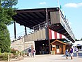 Grandstand at the Sheboygan County fairgrounds


References[change | change source]
- ↑ 1.0 1.1 1.2 "QuickFacts: Sheboygan County, Wisconsin". United States Census Bureau. Retrieved January 21, 2024.
- ↑ "Find a County". National Association of Counties. Retrieved 2008-01-31.
- ↑ "U.S. Decennial Census". United States Census Bureau. Retrieved August 9, 2015.
- ↑ "Historical Census Browser". University of Virginia Library. Archived from the original on August 11, 2012. Retrieved August 9, 2015.
- ↑ Forstall, Richard L., ed. (March 27, 1995). "Population of Counties by Decennial Census: 1900 to 1990". United States Census Bureau. Retrieved August 9, 2015.
- ↑ "Census 2000 PHC-T-4. Ranking Tables for Counties: 1990 and 2000" (PDF). United States Census Bureau. April 2, 2001. Archived (PDF) from the original on 2022-10-09. Retrieved August 9, 2015.
Other websites[change | change source]
- Sheboygan County Government Archived 2017-01-18 at the Wayback Machine
- Sheboygan County Chamber of Commerce
Places next to Sheboygan County, Wisconsin | ||||||||||
|---|---|---|---|---|---|---|---|---|---|---|
| ||||||||||
43°43′N 87°40′W / 43.72°N 87.66°W
