Sioux Falls, South Dakota
Sioux Falls, South Dakota | |
|---|---|
 Downtown Sioux Falls | |
| Nickname(s): Best Little City in America, Queen City of the West, The Heart of America | |
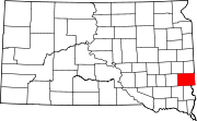
 Location within Minnehaha County | |
| Coordinates: 43°32′11″N 96°43′54″W / 43.53639°N 96.73167°W | |
| Country | United States |
| State | South Dakota |
| Counties | Minnehaha, Lincoln |
| Founded | 1879 |
| Incorporated | February 4, 1879[1] |
| Named for | The waterfall of the Big Sioux River |
| Area | |
| • City | 81.19 sq mi (210.27 km2) |
| • Land | 80.64 sq mi (208.87 km2) |
| • Water | 0.54 sq mi (1.40 km2) |
| Elevation | 1,463 ft (446 m) |
| Population | |
| • City | 192,517 |
| • Rank | US: 121st SD: 1st |
| • Density | 2,387.25/sq mi (921.72/km2) |
| • Urban | 194,283 (US: 197th) |
| • Urban density | 2,861.3/sq mi (1,104.8/km2) |
| • Metro | 289,592 (US: 171st) |
| • Metro density | 112.5/sq mi (43.42/km2) |
| Demonym | Siouxlander (unofficial) |
| Time zone | UTC–6 (Central (CST)) |
| • Summer (DST) | UTC–5 (CDT) |
| ZIP codes | Zip codes[7] |
| Area code | 605 |
| GNIS feature ID | 1267566[3] |
| Website | siouxfalls.gov |
Sioux Falls (pronounced "sue falls", English pronunciation: /suː fɔːlz/) is a city in the U.S. state of South Dakota. It is the largest city in the state; 192,517 people lived there at the 2020 census.[4] The city is in the eastern part of South Dakota. It is the county seat of Minnehaha County, where most of the city is located. The southern part of the city is in Lincoln County. Sioux Falls became a city in 1876.[8] The city is built around the Big Sioux River, and it gets its name from a set of waterfalls along the river that are located in a park in the city.[9]
Sports[change | change source]
Sioux Falls is home to four major sports teams. The Sioux Falls Skyforce play basketball in the NBA Development League, the Sioux Falls Canaries play baseball in the American Association, the Sioux Falls Stampede play ice hockey in the United States Hockey League, and the Sioux Falls Storm play American football in the Indoor Football League.
Transport[change | change source]
Two major Interstate highways go through Sioux Falls. Interstate 90 goes from east to west, and Interstate 29 goes from north to south. Sioux Falls also has a shorter route, Interstate 229, that serves the eastern part of the city and connects Interstate 90 to Interstate 29. The city is also home to the Sioux Falls Regional Airport, which has flights to many big cities across the country.
References[change | change source]
- ↑ "SD Towns" (PDF). South Dakota State Historical Society. Archived from the original (PDF) on February 10, 2010. Retrieved February 14, 2010.
- ↑ "2020 U.S. Gazetteer Files". United States Census Bureau. Retrieved July 24, 2022.
- ↑ 3.0 3.1 U.S. Geological Survey Geographic Names Information System: Sioux Falls, South Dakota
- ↑ 4.0 4.1 "QuickFacts: Sioux Falls city, South Dakota". United States Census Bureau. Retrieved February 15, 2024.
- ↑ "List of 2020 Census Urban Areas". census.gov. United States Census Bureau. Retrieved January 8, 2023.
- ↑ "2020 Population and Housing State Data". United States Census Bureau. Retrieved September 23, 2021.
- ↑ "Zip Code Lookup". USPS. Archived from the original on January 1, 2008. Retrieved May 22, 2015.
- ↑ "SD Towns" (PDF). South Dakota State Historical Society. Retrieved 2013-11-23.
- ↑ "Falls Park". South Dakota Department of Tourism. Retrieved 2013-11-23.
Other websites[change | change source]


