
Stamford, Lincolnshire
| Stamford | |
|---|---|
 High Street, St Martin's | |
 Coat of arms of Stamford | |
 Stamford | |
| Location within Lincolnshire | |
| Population | 19,701 (2011) |
| OS grid reference | TF0207 |
| Civil parish |
|
| Unitary authority | |
| Ceremonial county | |
| Region | |
| Country | England |
| Sovereign state | United Kingdom |
| Post town | STAMFORD |
| Postcode district | PE9 |
| Dialling code | 01780 |
| Police | Lincolnshire |
| Fire | Lincolnshire |
| Ambulance | East Midlands |
| UK Parliament | |
Stamford is a town and civil parish in Southern Lincolnshire, a county in England. It is on the River Welland and is located in the borough of South Kesteven. The town centre is 92 miles (148 km) north of London, the capital city.
The town is located very close to the borders with Cambridgeshire, Rutland and Northamptonshire. The town is in Lincolnshire, but has a Peterborough post code, a city in Cambridgeshire.
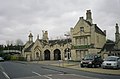
It is a very old town. Many 17th and 18th-century buildings and old timber-framed buildings still stand in the town. It also has five medieval churches.
There are over 600 listed buildings in the town and surrounding area.
The Sunday Times rated the town the best place to live in a survey in 2013.
Gallery[change | change source]
-
 Burghley House
 -
-
 River Welland flowing through the town
 -
 All Saints Street


| International | |
|---|---|
| National | |
| Geographic | |