Tizimín
Tizimín | |
|---|---|
 Church of the Three Kings of Tizimín. | |
| Motto: | |
| Coordinates: 21°08′33″N 88°09′53″W / 21.14250°N 88.16472°W | |
| Country | Mexico |
| State | Yucatán |
| Municipality | Tizimín Municipality |
| Government | |
| • Municipal president | José Dolores Mezo Peniche[3] (PAN[4]) |
| Elevation | 20 m (70 ft) |
| Population (2010)[5] | |
| • Total | 46,971 |
| Demonym | Tizimilean |
| Postal Code | 97700[6] |
| Prefix | 986[7] |
| Website | tizimin |
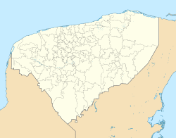
Tizimín is a city in Mexico.[8] The city is 100 miles east of Mérida city.[9]
In the Maya language, Tizimín means tapir. A tapir is a big animal that lives in South America.
References[change | change source]
- ↑ Diario de Yucatán. "Las procesiones, fundamentales en la celebración de los reyes". Retrieved September 13, 2011.[permanent dead link]
- ↑ Radio Mayab. "Crece la obra pública en la Ciudad de Reyes". Archived from the original on March 8, 2016. Retrieved September 27, 2011.
- ↑ IPEPAC. "Directorio de alcaldes electos" (PDF). Archived from the original (PDF) on September 16, 2011. Retrieved October 15, 2011.
- ↑ IPEPAC. "Alcaldías de Yucatán por partido político" (PDF). Archived from the original (PDF) on July 22, 2011. Retrieved October 15, 2011.
- ↑ Instituto Nacional de Estadística y Geografía (2010). "Principales resultados por localidad 2010 (ITER)".
- ↑ Servicio Postal Mexicano. "Consulta Códigos Postales". Archived from the original on July 28, 2011. Retrieved August 2, 2011.
- ↑ Telmex. "Claves LADA". Archived from the original on August 7, 2011. Retrieved August 2, 2011.
- ↑ Web site
- ↑ "Tizimín". Archived from the original on 2003-12-10. Retrieved 2008-05-19.


