Townsville
| Townsville Queensland | |||||||||
|---|---|---|---|---|---|---|---|---|---|
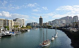
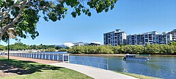
Townsville waterfront with North Queensland Stadium in the background | |||||||||
 | |||||||||
| Coordinates | 19°15′S 146°49′E / 19.250°S 146.817°E | ||||||||
| Population | 173,724 (UCL 2021)[1][2] | ||||||||
| Established | 1865 | ||||||||
| Postcode(s) | 4810 | ||||||||
| Elevation | 15 m (49 ft) | ||||||||
| Area | 693.3 km2 (267.7 sq mi)[3] (2021 urban) | ||||||||
| Time zone | AEST (UTC+10) | ||||||||
| Location |
| ||||||||
| LGA(s) | City of Townsville | ||||||||
| County | Elphinstone | ||||||||
| State electorate(s) | |||||||||
| Federal division(s) | |||||||||
| |||||||||
Townsville (Bindal: Thul Garrie Waja,[4] Warrongo: Gabilgaba)[5] is a city on the northern east coast of Queensland, Australia. It is the largest regional city in Queensland and in 2010 was made a second capital by Premier Anna Bligh to take the stress of governing off the southeast corner of Queensland. Before the city was made a capital, Townsville was often referred to as the capital of North Queensland, but the split of the state never occurred.
Popular attractions include 'The Strand', a long tropical beach and garden strip; Riverway, a riverfront parkland attraction on the banks of Ross River; Reef HQ, a large tropical aquarium holding many of the Great Barrier Reef's native flora and fauna; the Museum of Tropical Queensland, built around a display of relics from the sunken British warship HMS Pandora; and Magnetic Island, a large neighbouring island, the vast majority of which is national park.
History[change | change source]
English explorer James Cook went by the area where Townsville was established in 1770, but did not land. Townsville City was established in 1863 by English explorer Robert Towns to build a new port for Australia. Since then Townsville grew into a livable city as people began moving to up to the city.
World War II history[change | change source]
During World War II, Townsville was used by the Americans as a military base. There were many airbases, bunkers, tunnels and fortifications around Townsville, some of these forts are still visible, where as others have been demolished.
These still standing forts include:
- No. 3 Fighter Sector RAAF
- Green Street Bunker
- Castle Hill Magazine
- Castle Hill Command Post
- Pallarenda Batteries
Townsville was once referred to as Australia's Saviour, but this slowly faded away as history from the war in Townsville was destroyed to hide tunnels from the public.
1970s onwards[change | change source]
On Christmas Eve in 1971, Townsville was hit by Tropical Cyclone Althea, which destroyed the port almost completely. In 1982 Flinders Street in the CBD was closed to traffic and turned into a shopping mall. The Strand Beach was redeveloped into a tropical beach park with features such as a waterpark, the rockpool, and the War Museum.
References[change | change source]
- ↑ Australian Bureau of Statistics (28 June 2022). "Townsville (urban centre and locality)". Australian Census 2021 QuickStats. Retrieved 11 December 2022.
- ↑ Australian Bureau of Statistics (28 June 2022). "Townsville (urban centre and locality)". Australian Census 2021.
- ↑ Australian Bureau of Statistics (28 June 2022). "2021 Community Profiles: Townsville". 2021 Census of Population and Housing. Retrieved 9 August 2023.
- ↑ https://www.townsville.qld.gov.au/about-townsville/history-and-heritage/townsville-history/traditional-landowners
- ↑ https://www.scribd.com/doc/164615998/Grammar-of-Warrongo-Mouton-Grammar-Library-pdf


