Woolmer Green
| Woolmer Green | |
|---|---|
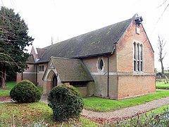
 St Michael and All Angels, Woolmer Green, by Robert Weir Schultz | |
| Location within Hertfordshire | |
| Population | 661 (2011 Census)[1] |
| OS grid reference | TL253186 |
| District | |
| Shire county | |
| Region | |
| Country | England |
| Sovereign state | United Kingdom |
| Post town | KNEBWORTH |
| Postcode district | SG3 |
| Dialling code | 01438 |
| Police | Hertfordshire |
| Fire | Hertfordshire |
| Ambulance | East of England |
| UK Parliament | |
Woolmer Green is a small village in Hertfordshire, England.
It is between the villages of Welwyn and Knebworth, Woolmer Green was first settled in the Iron Age. The Belgae colonised the area in the 1st century BC, and later it was settled by the Romans.
Many Roman artefacts have been found in the surrounding area. There was a Roman bath house at nearby Welwyn. The village was at the junction of two thoroughfares, the Great North Road and another road called Stane Street from St Albans. The route of this road runs across the parish along the path of Robbery Bottom Lane, continuing on as a public bridleway to Datchworth and then Braughing, on its way to another major Roman town, Colchester.
Thomas de Wolvesmere is recorded as having lived here in 1297, and his name may have led to the present name of the village.
References[change | change source]
- ↑ "Civil Parish population 2011". Neighbourhood Statistics. Office for National Statistics. Archived from the original on 4 November 2016. Retrieved 4 November 2016.
Other websites[change | change source]
- Woolmer Green website
- Population figures (PDF) Archived 2009-03-26 at the Wayback Machine
- For some newsreel about Harry the Woodcarver Archived 2012-02-07 at the Wayback Machine

