
File:Reliefkarte Waadt blank.png

Size of this preview: 711 × 600 pixels. Other resolutions: 285 × 240 pixels | 569 × 480 pixels | 911 × 768 pixels | 1,214 × 1,024 pixels | 2,429 × 2,048 pixels | 3,733 × 3,148 pixels.
Original file (3,733 × 3,148 pixels, file size: 6.6 MB, MIME type: image/png)
| This is a file from the Wikimedia Commons. Information from its description page there is shown below. Commons is a freely licensed media file repository. You can help. |
| Description |
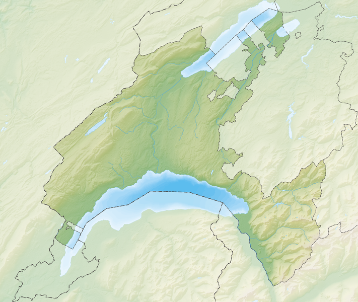
Deutsch: Reliefkarte des Kantons Waadt
Topographischer Hintergrund: NASA Shuttle Radar Topography Mission (public domain). SRTM3 v.2. |
||||||||
| Date | |||||||||
| Source | Own work | ||||||||
| Author | Tschubby | ||||||||
| Permission (Reusing this file) |
I, the copyright holder of this work, hereby publish it under the following licenses:
This file is licensed under the Creative Commons Attribution-Share Alike 2.5 Generic, 2.0 Generic and 1.0 Generic license.
You may select the license of your choice. |
||||||||
| Other versions |
 |

File history
Click on a date/time to view the file as it appeared at that time.
| Date/Time | Thumbnail | Dimensions | User | Comment | |
|---|---|---|---|---|---|
| current | 17:04, 26 December 2021 | | 3,733 × 3,148 (6.6 MB) | Tschubby | {{Information |Description= |Source= |Date= |Author= |Permission= |other_versions= }} |
| 12:03, 6 December 2013 |  | 3,111 × 2,627 (7.38 MB) | Tschubby | {{Information |Description= {{de| Reliefkarte des Kantons Waadt}} Topographischer Hintergrund: [http://www2.jpl.nasa.gov/srtm NASA Shuttle Radar Topography Mission] (public domain). SRTM3 v.2. |Source={{own}} |Date= 2013-12-06 |Author= [[:de:User:Tschu... |
File usage
More than 100 pages use this file. The following list shows the first 100 pages that use this file only. A full list is available.
- Agiez
- Aigle
- Apples, Vaud
- Aubonne
- Avenches
- Ballaigues
- Baulmes
- Bavois
- Bellerive, Switzerland
- Belmont-sur-Yverdon
- Bex
- Bioley-Magnoux
- Blonay
- Bofflens
- Bonvillars
- Bourg-en-Lavaux
- Brenles
- Bullet, Switzerland
- Bussy-sur-Moudon
- Carrouge, Vaud
- Champtauroz
- Chardonne
- Chavornay, Switzerland
- Chessel
- Chevroux, Switzerland
- Château-d'Œx
- Combremont-le-Petit
- Commugny
- Coppet
- Corbeyrier
- Corcelles-le-Jorat
- Corcelles-près-Concise
- Corseaux
- Corsier-sur-Vevey
- Cossonay
- Cremin
- Cully, Vaud
- Curtilles
- Duillier
- Faoug
- Giez
- Gimel, Switzerland
- Gollion
- Grandcour
- Granges-près-Marnand
- Gryon
- Jongny
- La Tour-de-Peilz
- Lausanne
- Lavey-Morcles
- Le Vaud
- Leysin
- Lovatens
- Lucens
- Lutry
- Mies, Switzerland
- Missy, Switzerland
- Montreux
- Morges
- Moudon
- Mutrux
- Noville, Switzerland
- Oleyres
- Ollon
- Ormont-Dessous
- Ormont-Dessus
- Palézieux
- Payerne
- Pomy, Switzerland
- Prilly
- Prévonloup
- Pully
- Renens
- Rennaz
- Roche, Vaud
- Ropraz
- Rossinière
- Rougemont, Switzerland
- Saint-Légier-La Chiésaz
- Suchy
- Tannay, Switzerland
- Territet
- Tolochenaz
- Trey, Vaud
- Tévenon
- Valbroye
- Vaugondry
- Veytaux
- Vich, Switzerland
- Villars-Sainte-Croix
- Villars-le-Comte
- Villarzel
- Villeneuve, Vaud
- Villette, Vaud
- Vinzel
- Vucherens
- Vulliens
- Vully-les-Lacs
- Yverdon-les-Bains
- Yvorne
View more links to this file.
Global file usage
The following other wikis use this file:
- Usage on bh.wikipedia.org
- Usage on de.wikipedia.org
- Schloss Chillon
- Chasseron
- La Dôle
- Mont Tendre
- Lac de Joux
- Lac Brenet
- Orbe (Fluss)
- Risoux
- Talent (Fluss)
- Col des Mosses
- Lac de l’Hongrin
- Col du Marchairuz
- Col de l’Aiguillon
- Col du Pillon
- Col du Mollendruz
- Col de la Givrine
- Col des Étroits
- Tour d’Aï
- HBG (Zeitzeichensender)
- Rochers de Naye
- Landessender Sottens
- Les Agites
- Mentue
- Petite Glâne
- Veyron (Fluss)
- Lac de Bret
- Mont Pèlerin
- Mormont (Berg)
- Dent de Vaulion
- Aiguilles de Baulmes
- Suchet (Berg)
- Mont Aubert
- Liste von Burgen und Schlössern in der Schweiz
- Noirmont (Berg)
- Crêt de la Neuve
- Les Pléiades
- Arrissoules-Tunnel
- Pomy-Tunnel
- Sender La Dôle
- Schloss Prangins
- Fernsehturm Mont Pèlerin
- Wikipedia:Kartenwerkstatt/Positionskarten/Europa
- Schloss Saint-Saphorin
- Île de Peilz
View more global usage of this file.