Divisions of the Australian House of Representatives
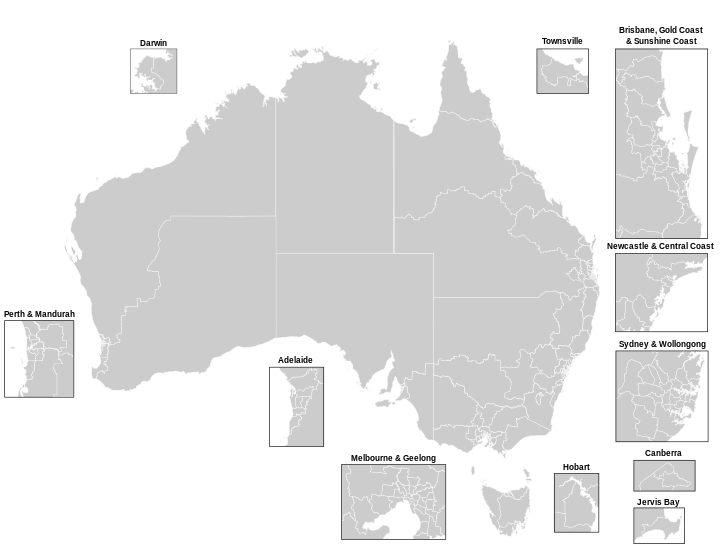
The Australian House of Representatives is elected from 151 single-member areas called Divisions. They are also commonly known as electorates or seats.
Allocation[change | change source]
The Divisions are divided among the states and territories of Australia as set out in the Australian Constitution and the Electoral Act[1] It is based on population, with the following exceptions:
- Each original state must have at least five Members of Parliament. This means that Tasmania has more divisions than it would get based on its population.
- The Northern Territory has been given more representation under recent legislative amendments[source?]
- The Constitution says that the House of Representatives should be about twice as large as the Senate
Within each state and territory, the boundaries of the divisions must be redrawn in a process known as redistribution at least once every seven years, or when the state's allocation of Divisions changes. Boundaries are drawn by Redistribution Committee. Population is based on the number of enrolled voters not the total number of residents.
Within a state or territory, the number of voters in each Division can not vary by more than 10% from the average across the state. The number of voters cannot vary by more than 3.5% from the average projected enrolment three-and-a-half years into the future.
Naming[change | change source]
The Divisions of the House of Representatives are unusual in the way they are named. Many of them are not named after geographical features or numbered, as in most other legislatures around the world. Most Divisions are named after important historical people, such as former politicians (often Prime Ministers), explorers, artists and engineers.
In some cases where a Division is named after a place, the connection to that place may have changed a lot. For example, the Division of Werriwa, was named after the Aboriginal word for Lake George near Canberra. However, Werriwa has not included Lake George for many years. The boundary of Werriwa is now 200km north of the lake.
The Australian Electoral Commission (AEC) is in charge of creating, abolishing, or redistributing the boundaries of the Divisions. Some of the guidelines the AEC use when naming new Divisions are listed below:[2]
- Name divisions after deceased Australians who have given excellent service to their country, with consideration given to former Prime Ministers
- Keep the names of Divisions used at Federation in 1901
- Avoid place names
- Use Aboriginal names
- Do not use names which are used as state electoral districts
List[change | change source]

New South Wales[change | change source]
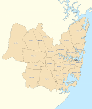
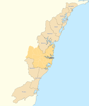
For the 2019 elections there were 47 Divisions:
 |
 |
 |
Victoria[change | change source]
 |
 |
 |
For the 2019 election there were 38 Divisions in Victoria:
Queensland[change | change source]
For the 2019 elections there were 30 Divisions:
 |
 |
 |
There are 30 Divisions in Queensland:
| Name | Map |
|---|---|
| Blair | Map |
| Bonner | Map |
| Bowman | Map |
| Brisbane | Map |
| Capricornia | Map |
| Dawson | Map |
| Dickson | Map |
| Fadden | Map |
| Fairfax | Map |
| Fisher | Map |
| Flynn | Map |
| Forde | Map |
| Griffith | Map |
| Groom | Map |
| Herbert | Map |
| Hinkler | Map |
| Kennedy | Map |
| Leichhardt | Map |
| Lilley | Map |
| Longman | Map |
| Maranoa | Map |
| McPherson | Map |
| Moncrieff | Map |
| Moreton | Map |
| Oxley | Map |
| Petrie | Map |
| Rankin | Map |
| Ryan | Map |
| Wide Bay | Map |
| Wright | Map |
Western Australia[change | change source]
For the 2019 election there were 16 Divisions:
 |
 |
 |
South Australia[change | change source]
For the 2019 elections there were 10 Divisions:
 |
 |
| Name | Map |
|---|---|
| Adelaide | Map |
| Barker | Map |
| Boothby | Map |
| Grey | Map |
| Hindmarsh | Map |
| Kingston | Map |
| Mayo | Map |
| Spence | Map |
| Sturt | Map |
Tasmania[change | change source]
For the 2019 election there were five Divisions:
| Name | Map |
|---|---|
| Bass | Map |
| Braddon | Map |
| Clark | Map |
| Franklin | Map |
| Lyons | Map |
Australian Capital Territory[change | change source]
| Name | Map |
|---|---|
| Bean | Map |
| Canberra | Map |
| Fenner | Map |
Northern Territory[change | change source]
There are two Divisions in the Northern Territory:
Abolished Divisions[change | change source]
These Australian Divisions no longer exist:
- Angas (1903–34) (SA)
- Angas (1949–77) (SA)
- Australian Capital Territory (1949–74) (ACT)
- Balaclava (1901–84) (VIC)
- Barrier (1901–22) (NSW)
- Batman (1906–2019) (VIC)
- Bland (1901–06) (NSW)
- Bonython (1955–2004) (SA)
- Bourke (1901–49) (VIC)
- Burke (1949–55) (VIC)
- Burke (1969–2004) (VIC)
- Canobolas (1901–06) (NSW)
- Charlton (1984–2016) (NSW)
- Cook (1906–55) (NSW)
- Coolgardie (1901–13) (WA)
- Corinella (1901–06) (VIC)
- Corinella (1990–96) (VIC)
- Dalley (1901–69) (NSW)
- Dampier (1913–22) (WA)
- Darebin (1949–69) (VIC)
- Darling (1901–77) (NSW)
- Darling Downs (1901–84) (QLD)
- Darwin (1903–55) (TAS)
- Denison (1903–2019) (TAS)
- Diamond Valley (1969–84) (VIC)
- Dundas (1977–93) (NSW)
- East Sydney (1901–69) (NSW)
- Echuca (1901–37) (VIC)
- Evans (1949–77) (NSW)
- Fawkner (1906–69) (VIC)
- Fraser (1974–2016) (ACT)
- Grampians (1901–22) (VIC)
- Gwydir (1901–2007) (NSW)
- Hawker (1969–93) (SA)
- Henty (1913–90) (VIC)
- Higinbotham (1949–69) (VIC)
- Hoddle (1949–55) (VIC)
- Illawarra (1901–22) (NSW)
- Isaacs (1949–69) (VIC)
- Kalgoorlie (1901–2010) (WA)
- Laanecoorie (1901–13) (VIC)
- Lang (1901–77) (NSW)
- Lawson (1949–69) (NSW)
- Lowe (1949–2010) (NSW)
- Martin (1922–55) (NSW)
- McMillan (1949–2019) (VIC)
- Melbourne Ports (1901–2019) (VIC)
- Mernda (1901–13) (VIC)
- Moira (1901–06) (VIC)
- Murray (1949–2019) (VIC)
- Namadgi (1996–98) (ACT)
- Nepean (1906–22) (NSW)
- Northern Melbourne (1901–06) (VIC)
- Northern Territory (1922–2001) (NT)
- Oxley (1901–34) (QLD)
- Parkes (1901–69) (NSW)
- Phillip (1949–93) (NSW)
- Port Adelaide (1949–2019) (SA)
- Prospect (1969–2010) (NSW)
- Riverina-Darling (1984–93) (NSW)
- Scullin (1955–69) (VIC)
- South Australia (1901–03) (SA)
- South Sydney (1901–34) (NSW)
- Southern Melbourne (1901–06) (VIC)
- St George (1949–93) (NSW)
- Stirling (1955-2022) (WA)
- Streeton (1984–90) (VIC)
- Tasmania (1901–03) (TAS)
- Throsby (1984–2016) (NSW)
- Wakefield (1903–2019) (SA)
- Watson (1934–69) (NSW)
- West Sydney (1901–69) (NSW)
- Wilmot (1903–84) (TAS)
- Wimmera (1901–77) (VIC)
- Yarra (1901–69) (VIC)
Other websites[change | change source]
- For an electoral history of each Division since Federation in 1901, see Adam Carr's Electoral Archive: Index of House of Representatives Divisions 1901-2001
References[change | change source]
- ↑ Australian Electoral Commission.Research Report 4 - Australian Federal Redistributions 1901-2003. Accessed May 5, 2008.
- ↑ Australian Electoral Commission. Guideline for Naming Divisions. August 3, 2007. Accessed May 5, 2008.


