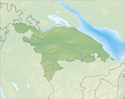
Bischofszell
Bischofszell | |
|---|---|
| Coordinates: 47°30′N 9°14′E / 47.500°N 9.233°E | |
| Country | Switzerland |
| Canton | Thurgau |
| District | Weinfelden |
| Area | |
| • Total | 11.7 km2 (4.5 sq mi) |
| Elevation | 506 m (1,660 ft) |
| Population (31 December 2018)[2] | |
| • Total | 6,016 |
| • Density | 510/km2 (1,300/sq mi) |
| Time zone | UTC+01:00 (Central European Time) |
| • Summer (DST) | UTC+02:00 (Central European Summer Time) |
| Postal code(s) | 9220 |
| SFOS number | 4471 |
| Surrounded by | Hauptwil-Gottshaus, Hohentannen, Kradolf-Schönenberg, Niederbüren (SG), Niederhelfenschwil (SG), Waldkirch (SG), Zihlschlacht-Sitterdorf |
| Twin towns | Möhringen, Tuttlingen (Germany), Battaglia Terme (Italy), Waidhofen an der Ybbs (Austria) |
| Website | www SFSO statistics |
Bischofszell is a municipality of the district of Weinfelden in the canton of Thurgau in the country of Switzerland. It has a population of 5,500 people.
The local industry is Bischofszell Konserven. It now belongs to Migros. They make jams, fruit juices, various cans, convenience food, among them Anna's Best.

References[change | change source]
- ↑ 1.0 1.1 "Arealstatistik Standard - Gemeinden nach 4 Hauptbereichen". Federal Statistical Office. Retrieved 13 January 2019.
- ↑ "Ständige Wohnbevölkerung nach Staatsangehörigkeitskategorie Geschlecht und Gemeinde; Provisorische Jahresergebnisse; 2018". Federal Statistical Office. 9 April 2019. Retrieved 11 April 2019.
Other websites[change | change source]
![]() Media related to Bischofszell at Wikimedia Commons
Media related to Bischofszell at Wikimedia Commons


