
Cache Creek, British Columbia
Village of Cache Creek | |
|---|---|
Village | |
 Where Cache Creek is found in British Columbia | |
| Coordinates: 50°48′50″N 121°19′36″W / 50.81389°N 121.32667°W | |
| Country | Canada |
| Province | British Columbia |
| Region | Thompson Country |
| Regional District | Thompson-Nicola |
| Incorporated | 1959 |
| Government | |
| • Mayor | P. A. John Ranta[1] |
| • Governing body | Cache Creek Village Council |
| Area | |
| • Total | 10.25 km2 (3.96 sq mi) |
| Elevation | 396 m (1,300 ft) |
| Population (2011) | |
| • Total | 1,040 |
| • Density | 101.5/km2 (263/sq mi) |
| Time zone | UTC-8 (PST) |
| • Summer (DST) | UTC−7 (PDT) |
| Website | Village of Cache Creek Website |
Cache Creek is a Canadian incorporated village and historic transportation in British Columbia, Canada. Cache Creek is in the Thompson Country of the Interior of British Columbia. The population of Cache Creek was 1,040 at the 2011 census.[2] The town of Cache Creek is on the Trans-Canada Highway. It is at the junction of northbound Highway 97. The name Cache Creek is believed to comes from a cache (a buried and hidden supply) and trade goods depot that was used by the fur traders of either the Hudson's Bay Company or the North West Company. The town is sometimes seen as the "twin" to nearby Ashcroft, which is not on the major highway unlike Cache Creek.
Gallery[change | change source]
-
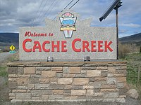 Welcome sign
 -
 Chevron Station

References[change | change source]
- ↑ "Council". Cache Creek. Archived from the original on 2014-09-17. Retrieved 2014-11-15.
- ↑ "Census Profile". Statistics Canada. 8 February 2012. Retrieved 2014-11-15.
Other websites[change | change source]