Cashtown, Pennsylvania
Cashtown, Pennsylvania | |
|---|---|
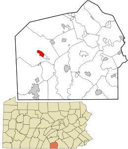
 Location in Adams County and the U.S. state of Pennsylvania. | |
| Coordinates: 39°53′2″N 77°21′31″W / 39.88389°N 77.35861°W | |
| Country | United States |
| State | Pennsylvania |
| County | Adams |
| Township | Franklin |
| Area | |
| • Total | 1.51 sq mi (3.92 km2) |
| • Land | 1.50 sq mi (3.89 km2) |
| • Water | 0.01 sq mi (0.03 km2) |
| Elevation | 746 ft (227 m) |
| Population | |
| • Total | 453 |
| • Density | 301.20/sq mi (116.33/km2) |
| Time zone | UTC-5 (Eastern (EST)) |
| • Summer (DST) | UTC-4 (EDT) |
| ZIP Codes | 17310 |
| FIPS code | 42-11576 |
| GNIS feature ID | 1171306 |
Cashtown is a census-designated place (CDP) in Franklin Township, Adams County, Pennsylvania, United States. The community was part of the Cashtown-McKnightstown CDP, until it was split into two separate CDPs for the 2010 census. As of 2020, the population of Cashtown was 453.[2]
History[change | change source]
During the American Civil War, Cashtown was occupied by the Confederate States Army twice. Once in October 1862 when Confederate cavalry led by General J.E.B. Stuart occupied the town briefly.[3] On June 28, 1863, General Robert E. Lee had invaded Pennsylvania a second time and was on his way to Harrisburg, Pennsylvania, the state capital.[4] When he received word that the Union Army of the Potomac was coming, he ordered his divisions to assemble at Cashtown.[3] On June 30 Confederate General Henry Heth had his divisions at Cashtown and sent a division to nearby Gettysburg to forage for supplies.[5] Without any reconnaissance to see what was ahead of them, the Confederates blundered into a Union cavalry commanded by General John Buford.[5] This started the Battle of Gettysburg.[5]
Geography[change | change source]
Cashtown is 13 miles (21 km) northwest of Gettysburg in western Adams County. U.S. Route 30 bypasses the center of the community. It forms the northern edge of the CDP. Old U.S. 30, the original Lincoln Highway, is the main street of Cashtown. McKnightstown is 1.5 miles (2.4 km) to the east.
References[change | change source]
- ↑ "ArcGIS REST Services Directory". United States Census Bureau. Retrieved October 12, 2022.
- ↑ 2.0 2.1 "Profile of General Population and Housing Characteristics: 2020 Demographic Profile Data (DP-1): Cashtown CDP, Pennsylvania". United States Census Bureau. Retrieved March 13, 2024.
- ↑ 3.0 3.1 George F. Skoch. "On the Road to Gettysburg". cashtowninn.com. Archived from the original on 9 September 2016. Retrieved 21 September 2016.
- ↑ Jerry L. Gleason (July 3, 2004). "Gen. Lee hoped for 'Battle of Harrisburg'". PennLive. PA Media Group. Archived from the original on 6 September 2016. Retrieved 21 September 2016.
- ↑ 5.0 5.1 5.2 "Battle of Gettysburg". U-S-History.com. Retrieved 21 September 2016.
