Charles City County, Virginia
Charles City County | |
|---|---|
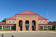
 Iona Whitehead-Adkins Courthouse | |
 Location within the U.S. state of Virginia | |
 Virginia's location within the U.S. | |
| Coordinates: 37°21′N 77°04′W / 37.35°N 77.06°W | |
| Country | |
| State | |
| Founded | 1619 |
| Named for | Charles I of England |
| Seat | Charles City |
| Area | |
| • Total | 204 sq mi (530 km2) |
| • Land | 183 sq mi (470 km2) |
| • Water | 21 sq mi (50 km2) 10.5% |
| Population (2020) | |
| • Total | 6,773 |
| • Density | 33/sq mi (13/km2) |
| Time zone | UTC−5 (Eastern) |
| • Summer (DST) | UTC−4 (EDT) |
| Congressional district | 4th |
| Website | www |
Charles City County is a county in the U.S. state of Virginia. As of the 2020 census, 6,773 people lived there. Its county seat is Charles City.[1]
References[change | change source]
- ↑ National Association of Counties. "NACo County Explorer". Retrieved January 25, 2024.
