Clay County, Kentucky
Clay County | |
|---|---|
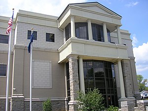
 Clay County courthouse in Manchester | |
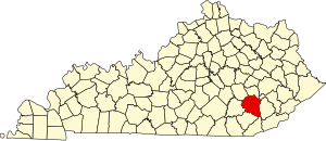
 Location within the U.S. state of Kentucky | |
 Kentucky's location within the U.S. | |
| Coordinates: 37°10′N 83°43′W / 37.16°N 83.71°W | |
| Country | |
| State | |
| Founded | 1807 |
| Named for | Green Clay |
| Seat | Manchester |
| Largest city | Manchester |
| Area | |
| • Total | 471 sq mi (1,220 km2) |
| • Land | 469 sq mi (1,210 km2) |
| • Water | 1.8 sq mi (5 km2) 0.4% |
| Population (2020) | |
| • Total | 20,345 |
| • Density | 43/sq mi (17/km2) |
| Time zone | UTC−5 (Eastern) |
| • Summer (DST) | UTC−4 (EDT) |
| Congressional district | 5th |
| Website | claycounty |
Clay County is a county in Kentucky.
