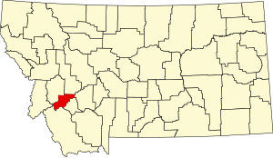
Deer Lodge County, Montana
Deer Lodge County | |
|---|---|
 Deer Lodge County Courthouse | |
 Location within the U.S. state of Montana | |
 Montana's location within the U.S. | |
| Coordinates: 46°07′14″N 112°59′15″W / 46.12062°N 112.98746°W | |
| Country | |
| State | |
| Founded | 1865 |
| Seat | Anaconda |
| Largest city | Anaconda |
| Area | |
| • Total | 741 sq mi (1,920 km2) |
| • Land | 737 sq mi (1,910 km2) |
| • Water | 4.7 sq mi (12 km2) 0.6% |
| Population (2020) | |
| • Total | 9,421 |
| • Density | 13/sq mi (4.9/km2) |
| Time zone | UTC−7 (Mountain) |
| • Summer (DST) | UTC−6 (MDT) |
| Congressional district | 1st |
| Website | www |
| |

Deer Lodge County is a county found in the U.S. state of Montana. As of the 2020 United States Census, there were 9,421 people.[1] It forms a consolidated city-county government with its county seat of Anaconda.[2] The county was created in 1865.[3]
References[change | change source]
- ↑ "QuickFacts: Deer Lodge County, Montana". United States Census Bureau. Retrieved January 4, 2024.
- ↑ "Find a County". National Association of Counties. Archived from the original on May 31, 2011. Retrieved June 7, 2011.
- ↑ "Montana Place Names Companion". Montana Place Names From Alzada to Zortman. Montana Historical Society Research Center. Retrieved December 1, 2014.

