
Dore (river)
| Dore | |
|---|---|
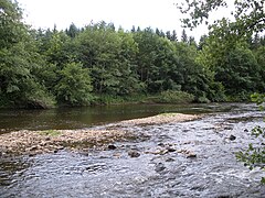
 upstream of Olliergues | |
.png) | |
| Location | |
| Country | France |
| Physical characteristics | |
| Source | |
| - location | Massif Central |
| Mouth | |
| - location | Allier |
| - coordinates | 46°0′34″N 3°28′26″E / 46.00944°N 3.47389°E |
| Length | 140 km (87 mi) |
| Basin size | 1,523 km2 (588 sq mi) |
| Discharge | |
| - average | 20 m3/s (710 cu ft/s) |
The Dore is a river in central France in the Auvergne-Rhône-Alpes region, in the Puy-de-Dôme department. It is a right tributary of the Allier river and it is one of the three more important tributaries of the Allier river (with the Sioule and Alagnon rivers).
Geography[change | change source]
The Dore river has a length of 140.5 km (87.3 mi), and a drainage basin with an area of 1,710 km2 (660 sq mi).[1]
Its valley is between the Monts du Forez, to the east, and the Monts du Livradois, to the west.
Course[change | change source]
The Dore starts in the place known as Bois de Berny, in the commune of Saint-Bonnet-le-Bourg, (Puy-de-Dôme department), at an altitude of about 1,034 m (3,392 ft).[2] From here, the Dore flows first to the southeast and then to the northwest.
The Dore river flows within the Auvergne-Rhône-Alpes region, the Puy-de-Dôme department and 21 communes. It flows through the following communes, among others: Dore-l’Église, Marsac-en-Livradois, Ambert, Vertolaye, Olliergues, Sauviat, Courpière, Néronde-sur-Dore, Peschadoires, Dorat, Puy-Guillaume.[1]
Finally, it flows into the Allier river in the commune of Ris.[3]
Main tributaries[change | change source]
The main tributaries of the Dore river are:[1]
|
Left tributaries:
|
|
Right tributaries:
|
Hydrology[change | change source]
Its average yearly discharge (volume of water which passes through a section of the river per unit of time) is 19.70 m3/s (696 cu ft/s) at Dorat in the Puy-de-Dôme department, for the period 1991 - 2017.[4]
Average monthly discharge (m3/s) at Dorat (1991 - 2017)[4]

Gallery[change | change source]
-
 Bridge over the Dore near Saint-Gervais-sous-Meymont.
 -
 The Dore near Thiers.
 -
 The Dore near Olliergues.
 -
 Dam on the Dore in Sauviat.


Related pages[change | change source]
References[change | change source]
- ↑ 1.0 1.1 1.2 "La Dore (K2--0190)" (in French). SANDRE - Portail national d'accès aux référentiels sur l'eau. Archived from the original on 28 May 2014. Retrieved 26 October 2017.
- ↑ "Source de la Dore" (in French). Géoportail. Retrieved 26 October 2017.
- ↑ "Confluence de la Dore" (in French). Géoportail. Retrieved 1 October 2017.
- ↑ 4.0 4.1 "La Dore à Dorat" (in French). Banque Hydro. Archived from the original on 13 December 2017. Retrieved 26 October 2017.