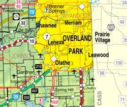
Fairway, Kansas
Fairway, Kansas | |
|---|---|
 Location within Johnson County and Kansas | |
 | |
| Coordinates: 39°1′26″N 94°37′45″W / 39.02389°N 94.62917°W[1] | |
| Country | United States |
| State | Kansas |
| County | Johnson |
| Founded | 1930s |
| Incorporated | 1949 |
| Area | |
| • Total | 1.13 sq mi (2.92 km2) |
| • Land | 1.13 sq mi (2.92 km2) |
| • Water | 0.00 sq mi (0.00 km2) |
| Elevation | 955 ft (291 m) |
| Population | |
| • Total | 4,170 |
| • Density | 3,700/sq mi (1,400/km2) |
| Time zone | UTC-6 (CST) |
| • Summer (DST) | UTC-5 (CDT) |
| ZIP code | 66205 |
| Area code | 913 |
| FIPS code | 20-22700 |
| GNIS ID | 485573[1] |
| Website | fairwaykansas.org |
Fairway is a city in Johnson County, Kansas, United States. It is part of the Kansas City Metropolitan Area. In 2020, 4,170 people lived there.[3]
History[change | change source]
In the 1820s, this area was used by the Shawnee people, who had ceded lands east of the Mississippi River to the United States government. The Shawnee Methodist Mission was moved here in 1839. This was when a school for the Shawnee people was created. During Territorial Kansas, it was the pro-slavery capital for a short time. After the American Civil War, the Shawnee were moved to the Indian Territory (present-day Oklahoma). The mission is a National Historic Landmark, and is used as a museum.
In the 1930s, as Kansas City suburbs were developing, a developer laid out a subdivision near a golf course. It was named Fairway because it was close to several driving ranges.[4] Fairway was incorporated in 1949, it and is known as "The City of Trees".[5]
Geography[change | change source]
Fairway is at 39°1′26″N 94°37′45″W / 39.02389°N 94.62917°W (39.023988, -94.629213).[6] The United States Census Bureau says that the city has a total area of 1.13 square miles (2.93 km2). All of it is land.[2]
People[change | change source]
| Historical population | |||
|---|---|---|---|
| Census | Pop. | %± | |
| 1950 | 1,816 | — | |
| 1960 | 5,398 | 197.2% | |
| 1970 | 5,227 | −3.2% | |
| 1980 | 4,619 | −11.6% | |
| 1990 | 4,173 | −9.7% | |
| 2000 | 3,952 | −5.3% | |
| 2010 | 3,882 | −1.8% | |
| 2020 | 4,170 | 7.4% | |
| U.S. Decennial Census | |||
2020 census[change | change source]
The 2020 census says that there were 4,170 people, 1,755 households, and 1,154 families living in Fairway. Of the households, 85.8% owned their home and 14.2% rented their home.
The median age was 39.0 years. Of the people, 90.0% were White, 2.0% were Asian, 0.9% were Black, 0.1% were Native American, 0.7% were from some other race, and 6.3% were two or more races. Hispanic or Latino of any race were 4.5% of the people.[3][7]
2010 census[change | change source]
In 2010, there were 3,882 people, 1,749 households, and 1,062 families living in Fairway. The population density was 3,375.7 inhabitants per square mile (1,303.4/km2). 95.3% of the people were White, 0.8% were African American, 0.3% were Native American, 1.4% were Asian, 0.7% were from other races, and 1.4% were from two or more races. 3.0% of the people were Hispanic or Latino of any race .[8]
2000 census[change | change source]
In 2000, there were 3,952 people, 1,781 households, and 1,102 families living in Fairway. The population density was 3,468.8 people per square mile (1,338.5/km²).
Education[change | change source]
The Johnson County Library services Fairway, KS. The library has 13 locations in Johnson County.
Famous people[change | change source]
Famous people who were born in and/or have lived in Fairway include:
- Frank L. Hagaman (1894-1966), 31st Governor of Kansas[9]
- Melissa Rooker (1964- ), Kansas state legislator[10]
- Greg Orman, Kansas Gubernatorial Candidate
References[change | change source]
- ↑ 1.0 1.1 1.2 U.S. Geological Survey Geographic Names Information System: Fairway, Kansas
- ↑ 2.0 2.1 "2020 U.S. Gazetteer Files". United States Census Bureau. Retrieved December 12, 2023.
- ↑ 3.0 3.1 3.2 "DP1: PROFILE OF GENERAL POPULATION AND HOUSING CHARACTERISTICS". United States Census Bureau. Retrieved December 12, 2023.
- ↑ "Fairway, Kansas". JoCoHistory. Johnson County Museum. Retrieved 12 June 2014.
- ↑ Fairway, KS -- Welcome to Fairway, KS, Fairway city website. Accessed 2008-05-26.
- ↑ "US Gazetteer files: 2010, 2000, and 1990". United States Census Bureau. 2011-02-12. Retrieved 2011-04-23.
- ↑ "P16: HOUSEHOLD TYPE". United States Census Bureau. Retrieved December 31, 2023.
- ↑ "American FactFinder". United States Census Bureau. Retrieved 2012-07-06.
- ↑ Sharp, James Roger; Sharp, nancy Weatherly, eds. (1997). American Legislative Leaders in the Midwest, 1911-1994. Santa Barbara, CA: Greenwood Publishing Group. p. 120.
- ↑ "Melissa Rooker's Biography". Vote Smart. Retrieved 2016-03-25.
More reading[change | change source]
- "Thomas Johnson's Story and the History of Fairway, Kansas". Joe H. Vaughan, Author. (2014) ISBN No. 978-63173-140-2. Two Trails Publishing Co., Inc., Independence, Mo. 64052.
Other websites[change | change source]
- City
- Maps
- Fairway City Map, KDOT

